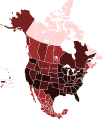
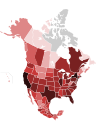
File:COVID-19 cases by territories of the countries of North America.svg
外觀

此 SVG 檔案的 PNG 預覽的大小:512 × 596 像素。 其他解析度:206 × 240 像素 | 412 × 480 像素 | 660 × 768 像素 | 880 × 1,024 像素 | 1,759 × 2,048 像素。
原始檔案 (SVG 檔案,表面大小:512 × 596 像素,檔案大小:139 KB)
檔案歷史
點選日期/時間以檢視該時間的檔案版本。
| 日期/時間 | 縮圖 | 尺寸 | 用戶 | 備註 | |
|---|---|---|---|---|---|
| 目前 | 2020年12月18日 (五) 15:24 |  | 512 × 596(139 KB) | Fluffy89502 | ontario |
| 2020年12月18日 (五) 04:43 |  | 512 × 596(139 KB) | Fluffy89502 | update | |
| 2020年7月24日 (五) 06:19 |  | 1,789 × 2,154(329 KB) | DOSGuy | This map is full of fail. There haven't been less cases in BC and Alberta than in Saskatchewan in months. Desperately needs a complete review. | |
| 2020年7月4日 (六) 04:34 |  | 1,789 × 2,154(322 KB) | YanpolGG | Uploaded own work with UploadWizard |
檔案用途
下列頁面有用到此檔案:
全域檔案使用狀況
以下其他 wiki 使用了這個檔案:
- en.wikipedia.org 的使用狀況
- es.wikipedia.org 的使用狀況
- ja.wikipedia.org 的使用狀況
- ko.wikipedia.org 的使用狀況
- sq.wikipedia.org 的使用狀況
- uk.wikipedia.org 的使用狀況
- vi.wikipedia.org 的使用狀況

