
File:DEMBauges.png

預覽大小:669 × 599 像素。 其他解析度:268 × 240 像素 | 536 × 480 像素 | 858 × 768 像素 | 1,143 × 1,024 像素 | 1,858 × 1,664 像素。
原始檔案 (1,858 × 1,664 像素,檔案大小:1.34 MB,MIME 類型:image/png)
摘要
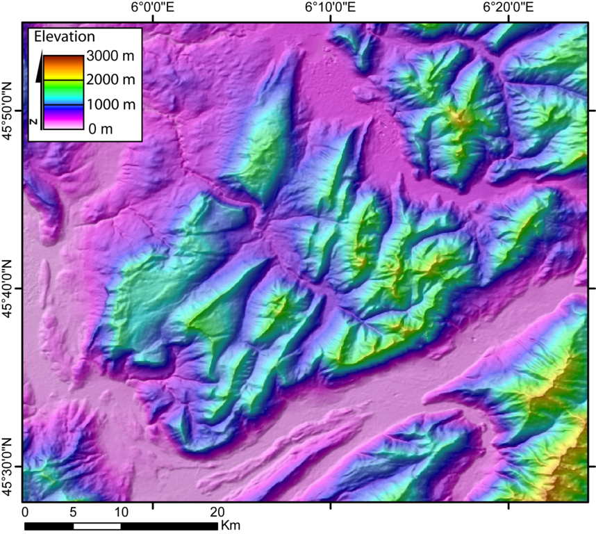
| 描述 | DEM of the Bauges massifs (french Alps) created by Jide from the 90m pixel size SRTM dataset. The massif is located between the Bourget Lake (to the West) and the Annecy Lake (to the NE). The ENE-WSW valley to the South is the Isere valley downstrem to the West). The Cheran river cut the massif from the SE to the NW. |
| 日期 | 2005年十一月5日 (原始上傳日期) |
| 來源 | 无法识别来源。根据版权声明推断为其自己的作品。 |
| 作者 | 无法识别作者。根据版权声明推断作者为Jide~commonswiki。 |
授權條款
| 我,此作品的版權所有人,釋出此作品至公共領域。此授權條款在全世界均適用。 這可能在某些國家不合法,如果是的話: 我授予任何人有權利使用此作品於任何用途,除受法律約束外,不受任何限制。 |
檔案歷史
點選日期/時間以檢視該時間的檔案版本。
| 日期/時間 | 縮圖 | 尺寸 | 用戶 | 備註 | |
|---|---|---|---|---|---|
| 目前 | 2005年11月5日 (六) 00:29 | | 1,858 × 1,664(1.34 MB) | Jide~commonswiki | DEM of the Bauges massifs (french Alps) created by Jide from the 90m pixel size SRTM dataset. The massif is located between the Bourget Lake (to the West) and the Annecy Lake (to the NE). The ENE-WSW valley to the South is the Isere valley downstrem to th |
檔案用途
下列頁面有用到此檔案:
全域檔案使用狀況
以下其他 wiki 使用了這個檔案: