
File:GVRD Electoral A.svg

此 SVG 檔案的 PNG 預覽的大小:795 × 600 像素。 其他解析度:318 × 240 像素 | 636 × 480 像素 | 1,018 × 768 像素 | 1,280 × 966 像素 | 2,560 × 1,931 像素 | 953 × 719 像素。
原始檔案 (SVG 檔案,表面大小:953 × 719 像素,檔案大小:163 KB)
| 描述 |
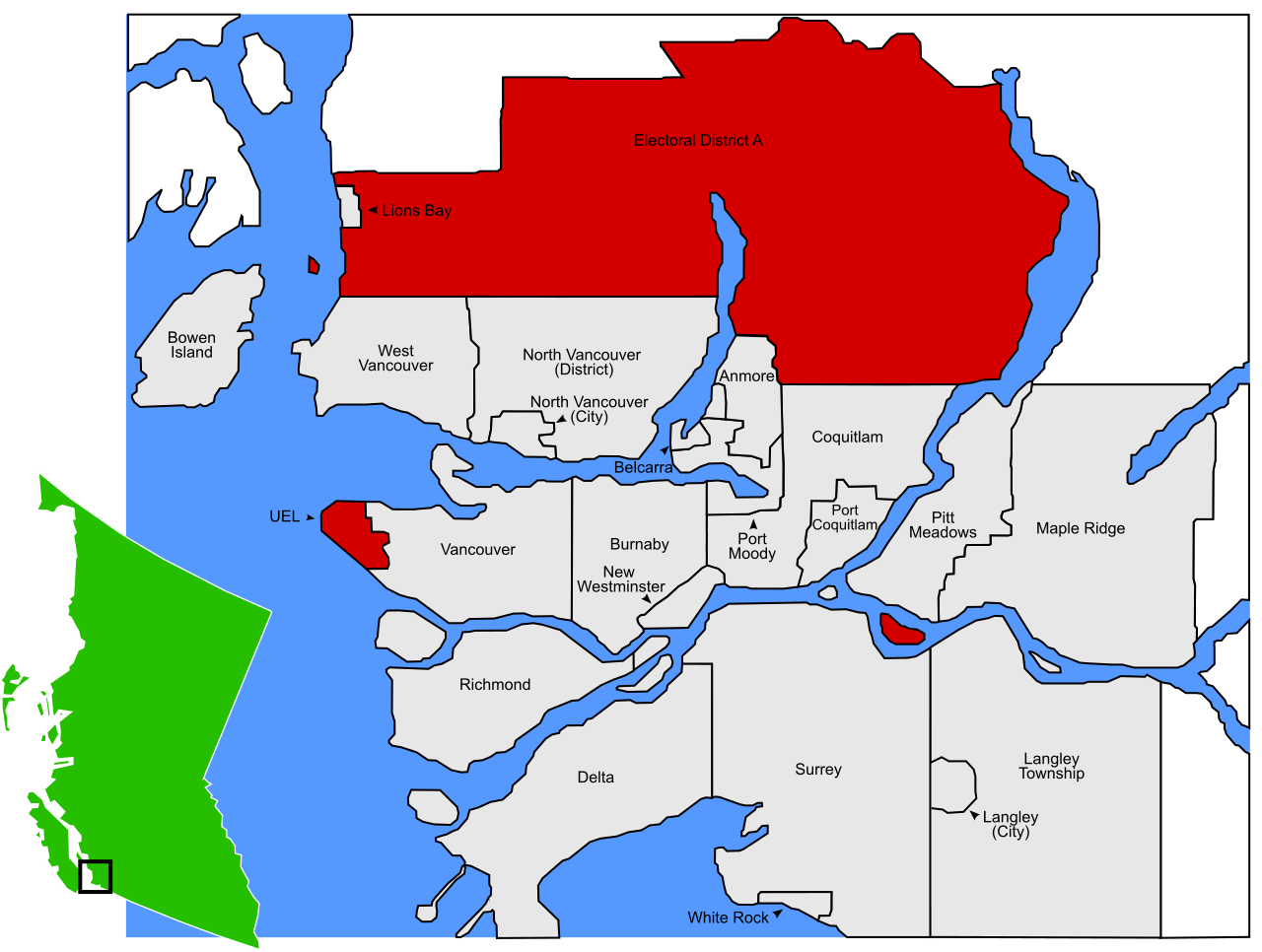
English: A map of Electoral District A in the GVRD. Electoral District A is shown in red. The map, and the others in this series, were originally derived from this png map made by Qyd.
|
| 日期 | (UTC) |
| 來源 | |
| 作者 |
|
| 這是一張修飾過的圖片,即本圖片是用軟體修改過後的版本。原版圖片來源:GVRD - Electoral District A.svg。
|
我,本作品的著作權持有者,決定用以下授權條款發佈本作品:
此檔案採用創用CC 姓名標示 3.0 未在地化版本授權條款。
- 您可以自由:
- 分享 – 複製、發佈和傳播本作品
- 重新修改 – 創作演繹作品
- 惟需遵照下列條件:
- 姓名標示 – 您必須指名出正確的製作者,和提供授權條款的連結,以及表示是否有對內容上做出變更。您可以用任何合理的方式來行動,但不得以任何方式表明授權條款是對您許可或是由您所使用。
原始上傳日誌
This image is a derivative work of the following images:
- File:GVRD_-_Electoral_District_A.svg licensed with Cc-by-3.0
- 2009-01-16T22:14:24Z TastyCakes 953x719 (306476 Bytes) {{Information |Description={{en|1=Electoral District A in the GVRD. Electoral District A in red.{{inkscape}}}} |Source=Own work by uploader |Author=[http://en.wikipedia.org/wiki/User:TastyCakes TastyCakes] on English Wikiped
Uploaded with derivativeFX
檔案歷史
點選日期/時間以檢視該時間的檔案版本。
| 日期/時間 | 縮圖 | 尺寸 | 用戶 | 備註 | |
|---|---|---|---|---|---|
| 目前 | 2022年7月15日 (五) 23:43 | | 953 × 719(163 KB) | Kelvinc | Douglas Island at mouth of Pitt River is part of Port Coquitlam (i.e. not part of EAA) since 1991 https://www.portcoquitlam.ca/wp-content/uploads/2017/11/Heritage-Resource-Inventory.pdf |
| 2012年7月4日 (三) 04:28 |  | 953 × 719(165 KB) | Emarsee | +Bowyer Island | |
| 2009年12月21日 (一) 01:53 |  | 953 × 719(163 KB) | Emarsee | {{Information |Description={{en|1=A map of Electoral District A in the GVRD. Electoral District A is shown in red. The map, and the others in this series, were originally derived from this png map made by [http://en.wikipedia.org/ |
檔案用途
下列頁面有用到此檔案: