
File:Icy Crater on Mars ESP 016954 2245 subimage 2.jpg

預覽大小:600 × 600 像素。 其他解析度:240 × 240 像素 | 480 × 480 像素。
原始檔案 (800 × 800 像素,檔案大小:560 KB,MIME 類型:image/jpeg)
| 描述 |
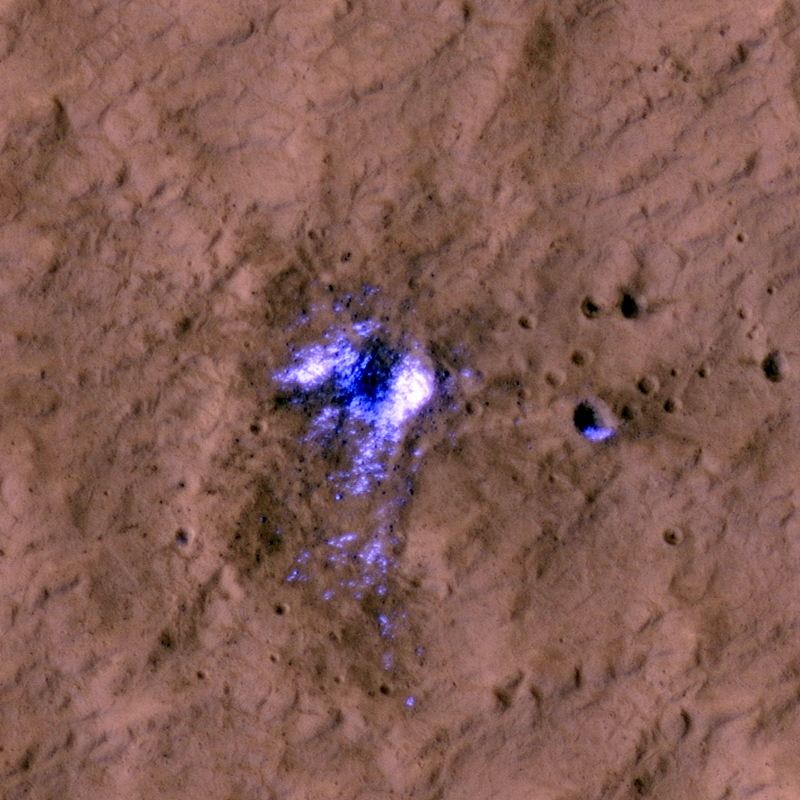
English: A newly formed impact crater, observed by HiRISE on Mars Reconnaissance Orbiter. The impact that formed the crater exposed the water ice beneath the surface. Some of the ice can be seen scattered at the adjascent area in the subimages. The blast zone (excavated dark material) is almost 800 meters (half a mile) across. The crater itself is just over 20 meters (66 feet) across
Ελληνικά: Ένας νεοσχηματισμένος κρατήρας στην επιφάνεια του Άρη. Ο κρατήρας φτάνει μέχρι το στρώμα πάγου που βρίσκεται κάτω από το έδαφος. Εικόνα από το τηλεσκόπιο HiRISE, στη διαστημοσυσκευή Mars Reconnaissance Orbiter της NASA. |
|||||
| 日期 | ||||||
| 來源 | HiRISE webpage with full description, file | |||||
| 作者 | NASA/JPL/University of Arizona | |||||
| 授權許可 (重用此檔案) |
|
|||||
| 其他版本 |
  |

| 火星上的位置 | 位於此地的本圖片與其他圖片: Google地图 |
|---|
檔案歷史
點選日期/時間以檢視該時間的檔案版本。
| 日期/時間 | 縮圖 | 尺寸 | 用戶 | 備註 | |
|---|---|---|---|---|---|
| 目前 | 2011年9月18日 (日) 14:49 | | 800 × 800(560 KB) | Badseed | {{Information |Description={{en|A newly formed impact crater, observed by HiRISE on Mars Reconnaissance Orbiter. The impact that formed the crater exposed the water ice beneath the surface. Some of the ice can be seen scattered at the adjascent area in th |
檔案用途
下列頁面有用到此檔案:
全域檔案使用狀況
以下其他 wiki 使用了這個檔案:
- ar.wikipedia.org 的使用狀況
- beta.wikiversity.org 的使用狀況
- de.wikipedia.org 的使用狀況
- en.wikiversity.org 的使用狀況
- id.wikipedia.org 的使用狀況
- ru.wikipedia.org 的使用狀況