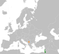
File:Israel Kosovo Locator.png
外觀

預覽大小:656 × 600 像素。 其他解析度:263 × 240 像素 | 525 × 480 像素 | 840 × 768 像素 | 1,270 × 1,161 像素。
原始檔案 (1,270 × 1,161 像素,檔案大小:90 KB,MIME 類型:image/png)
檔案歷史
點選日期/時間以檢視該時間的檔案版本。
| 日期/時間 | 縮圖 | 尺寸 | 用戶 | 備註 | |
|---|---|---|---|---|---|
| 目前 | 2012年2月29日 (三) 01:33 |  | 1,270 × 1,161(90 KB) | WhiteWriter | fix new image |
| 2012年2月2日 (四) 19:27 |  | 1,000 × 500(95 KB) | WhiteWriter | that is not kosovo, that is macedonia.... | |
| 2012年2月2日 (四) 04:26 |  | 1,270 × 1,161(76 KB) | Phoenix B 1of3 | New Map | |
| 2010年12月3日 (五) 02:26 |  | 1,000 × 500(95 KB) | Ph 1980 | {{Information |Description=Location map for Israel. Originally created for English Wikipedia by Vardion. |Source=*File:LocationIsrael.png |Date=2010-12-03 02:24 (UTC) |Author=*File:LocationIsrael.png: '''ph_1980''' *deriv |
檔案用途
下列頁面有用到此檔案:
全域檔案使用狀況
以下其他 wiki 使用了這個檔案:
- ar.wikipedia.org 的使用狀況
- en.wikipedia.org 的使用狀況
- fa.wikipedia.org 的使用狀況
- fr.wikipedia.org 的使用狀況
- he.wikipedia.org 的使用狀況
- id.wikipedia.org 的使用狀況
- ru.wikipedia.org 的使用狀況
- sq.wikipedia.org 的使用狀況
- tr.wikipedia.org 的使用狀況
- www.wikidata.org 的使用狀況


