
File:JezreelZionistMap1925-bright.jpg

預覽大小:800 × 513 像素。 其他解析度:320 × 205 像素 | 640 × 410 像素 | 1,024 × 656 像素 | 1,280 × 820 像素 | 3,100 × 1,987 像素。
原始檔案 (3,100 × 1,987 像素,檔案大小:966 KB,MIME 類型:image/jpeg)
摘要
| 描述 |
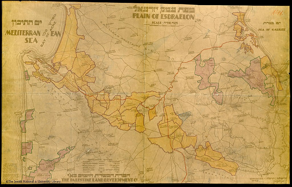
English: This map shows the Jewish land holdings in the Jezreel Valley (Plain of Esdraelon) in Palestine in 1925. The meaning of the colors is not explained but may indicate which Zionist company bought the land. |
| 日期 | |
| 來源 | National Library of Israel |
| 作者 | The Palestine Land Development Co. |
授權條款
本作品由以色列国创作或订购,由于其符合以色列2007年版权法(翻译)关于国家版权的规定,因而属于公共领域:
|

|
檔案歷史
點選日期/時間以檢視該時間的檔案版本。
| 日期/時間 | 縮圖 | 尺寸 | 用戶 | 備註 | |
|---|---|---|---|---|---|
| 目前 | 2021年2月8日 (一) 03:03 | | 3,100 × 1,987(966 KB) | Zero0000 | Uploaded a work by The Palestine Land Development Co. from National Library of Israel with UploadWizard |
檔案用途
下列頁面有用到此檔案:
全域檔案使用狀況
以下其他 wiki 使用了這個檔案:
- en.wikipedia.org 的使用狀況
- es.wikipedia.org 的使用狀況