
File:Location Bié.PNG
此為最大尺寸。
Location_Bié.PNG (361 × 363 像素,檔案大小:97 KB,MIME 類型:image/png)
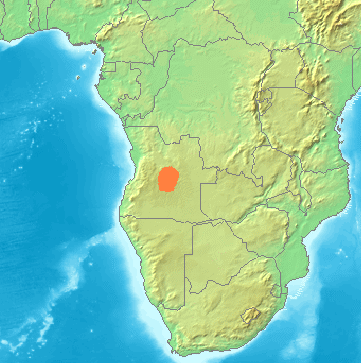
| 描述 | Locator maps for mountain ranges , Bié (Angola) |
| 來源 | demis maps, see below |
| 作者 |
This image is in the public domain because it came from the site https://www.demis.nl/products/web-map-server/examples/ and was released by the copyright holder. Permission is granted to copy, distribute and/or modify this map since it is based on free of copyright images from: www.demis.nl. See also approval email on de.wp and its clarification.
|
| This work has been released into the public domain by its copyright holder, www.demis.nl. This applies worldwide. 這可能在某些國家不合法,如果是的話: www.demis.nl授予任何人有權利使用此作品於任何用途,除受法律約束外,不受任何限制。
|
檔案歷史
點選日期/時間以檢視該時間的檔案版本。
| 日期/時間 | 縮圖 | 尺寸 | 用戶 | 備註 | |
|---|---|---|---|---|---|
| 目前 | 2021年11月23日 (二) 03:16 | | 361 × 363(97 KB) | Hallel | Reverted to version as of 14:38, 29 June 2007 (UTC) |
| 2021年8月11日 (三) 15:59 |  | 361 × 363(241 KB) | Fährtenleser | falsche Lage korrigiert (Grundlage: http://mountainbiodiversity.org/explore sowie Topographie | |
| 2007年6月29日 (五) 14:38 |  | 361 × 363(97 KB) | Michiel1972 | {{Information |Description=Locator maps for mountain ranges , Bié (Angola) |Source=demis maps, see below |Date= |Author= |Permission=see below |other_versions= }} {{PD-Demis}} Category:Maps of mountain_ranges_of_Europe |
檔案用途
下列頁面有用到此檔案:
全域檔案使用狀況
以下其他 wiki 使用了這個檔案:
- bg.wikipedia.org 的使用狀況
- ca.wikipedia.org 的使用狀況
- ceb.wikipedia.org 的使用狀況
- cs.wikipedia.org 的使用狀況
- de.wikipedia.org 的使用狀況
- en.wikipedia.org 的使用狀況
- es.wikipedia.org 的使用狀況
- fr.wikipedia.org 的使用狀況
- hr.wikipedia.org 的使用狀況
- hu.wikipedia.org 的使用狀況
- it.wikipedia.org 的使用狀況
- lt.wikipedia.org 的使用狀況
- nl.wikipedia.org 的使用狀況
- pl.wikipedia.org 的使用狀況
- pt.wikipedia.org 的使用狀況
- sh.wikipedia.org 的使用狀況
- uk.wikipedia.org 的使用狀況
- www.wikidata.org 的使用狀況