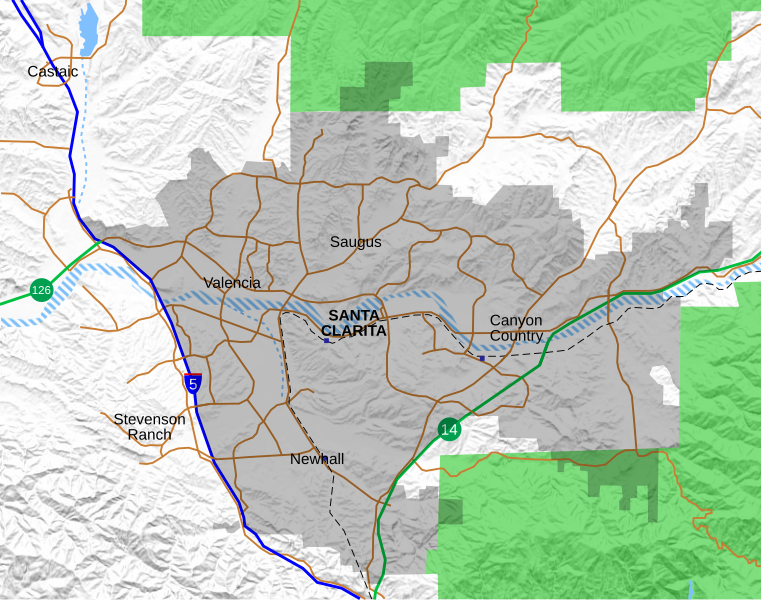
File:Location map Santa Clarita.svg
外觀

此 SVG 檔案的 PNG 預覽的大小:761 × 599 像素。 其他解析度:305 × 240 像素 | 610 × 480 像素 | 975 × 768 像素 | 1,280 × 1,008 像素 | 2,560 × 2,016 像素 | 796 × 627 像素。
原始檔案 (SVG 檔案,表面大小:796 × 627 像素,檔案大小:1.89 MB)
檔案歷史
點選日期/時間以檢視該時間的檔案版本。
| 日期/時間 | 縮圖 | 尺寸 | 用戶 | 備註 | |
|---|---|---|---|---|---|
| 目前 | 2021年9月24日 (五) 21:05 |  | 796 × 627(1.89 MB) | Crossover1370 | Remove the relatively minor Canyon Park Blvd and Lost Canyon Rd, and add Tourney Rd, a major street home to numerous hotels, government, and medical offices. |
| 2021年9月21日 (二) 21:47 |  | 796 × 627(1.89 MB) | Crossover1370 | A few minor changes involving 3-D placement of certain roads and railroads | |
| 2021年9月20日 (一) 22:56 |  | 796 × 627(1.89 MB) | Crossover1370 | Move the word "Santa Clarita" to top to allow it to be selected like the neighborhood names (no visible difference) | |
| 2021年9月20日 (一) 22:11 |  | 796 × 627(1.89 MB) | Crossover1370 | Sand Canyon Road and Newhall Ranch Road both pass above their respective freeways. Also add Metrolink stations. | |
| 2021年9月20日 (一) 01:15 |  | 796 × 627(1.89 MB) | Crossover1370 | Correct 3D position of streets relative to I-5, rearrange certain objects | |
| 2021年9月19日 (日) 07:01 |  | 796 × 627(1.89 MB) | Crossover1370 | Changed outline of Santa Clarita to shading, add Metrolink train and more streets | |
| 2021年3月26日 (五) 18:31 |  | 797 × 628(1,015 KB) | Crossover1370 | Remove section of Placerita Canyon Road west of Sierra Highway - not a major street. | |
| 2021年3月26日 (五) 01:23 |  | 797 × 628(1,016 KB) | Crossover1370 | Removed some minor streets I added in the previous revision. | |
| 2021年3月25日 (四) 07:11 |  | 797 × 628(1,016 KB) | Crossover1370 | Added more major streets. | |
| 2020年12月23日 (三) 05:10 |  | 797 × 628(1,013 KB) | Crossover1370 | Santa Clara River is still a big black blob. Hopefully this will fix it. |
檔案用途
沒有使用此檔案的頁面。
全域檔案使用狀況
以下其他 wiki 使用了這個檔案:
- en.wikipedia.org 的使用狀況
- Valencia, Santa Clarita, California
- The Master's University
- Newhall Pass
- Castaic, California
- Six Flags Magic Mountain
- College of the Canyons
- Stevenson Ranch, California
- Newhall, Santa Clarita, California
- Canyon Country, Santa Clarita, California
- Saugus, Santa Clarita, California
- Golden Oak Ranch
- Castaic Junction, California
- Santa Clarita, California
- Mentryville, California
- Rancho San Francisco
- Newhall incident
- Gibbon Conservation Center
- Placerita Canyon State Park
- Valencia, California
- Lyons Station Stagecoach Stop
- Peter J. Pitchess Detention Center
- Dry Canyon Reservoir
- Sand Canyon, Santa Clarita, California
- User:Crossover1370
- Beale's Cut Stagecoach Pass
- Lang Southern Pacific Station
- Pioneer Oil Refinery
- 2019 Saugus High School shooting
- Valencia Country Club
- Central Park (Santa Clarita)
- Module:Location map/data/Santa Clarita
- Module:Location map/data/Santa Clarita/doc
- Santa Clarita Woodlands Park
- McBean Regional Transit Center
- William S. Hart Regional Park
- fy.wikipedia.org 的使用狀況
- si.wikipedia.org 的使用狀況
- sv.wikipedia.org 的使用狀況

