
File:Map of the N4 (South Africa).svg

此 SVG 檔案的 PNG 預覽的大小:684 × 599 像素。 其他解析度:274 × 240 像素 | 548 × 480 像素 | 876 × 768 像素 | 1,168 × 1,024 像素 | 2,337 × 2,048 像素 | 809 × 709 像素。
原始檔案 (SVG 檔案,表面大小:809 × 709 像素,檔案大小:486 KB)
.svg?uselang=zh-mo)
.svg?uselang=zh-mo)
.svg?action=history&uselang=zh-mo)
.svg)
摘要
| 描述 |
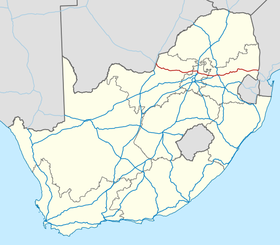
English: Map of the N4 national road in South Africa. |
| 日期 | |
| 來源 | Based on File:Map of the National Roads of South Africa.svg |
| 作者 | Htonl |
| 其他版本 |
Map of the N4 (South Africa) with labels.svg: |
| SVG開發 |
_with_labels.svg)
授權條款
此檔案採用共享創意 姓名標示-相同方式分享 3.0 未在地化版本授權條款。
- 您可以自由:
- 分享 – 複製、發佈和傳播本作品
- 重新修改 – 創作演繹作品
- 惟需遵照下列條件:
- 姓名標示 – 您必須指名出正確的製作者,和提供授權條款的連結,以及表示是否有對內容上做出變更。您可以用任何合理的方式來行動,但不得以任何方式表明授權條款是對您許可或是由您所使用。
- 相同方式分享 – 如果您利用本素材進行再混合、轉換或創作,您必須基於如同原先的相同或兼容的條款,來分布您的貢獻成品。
| This work contains information from OpenStreetMap, which is made available under the Open Database License (ODbL).
The ODbL does not require any particular license for maps produced from ODbL data. Prior to 1 August 2020, map tiles produced by the OpenStreetMap Foundation were licensed under the CC-BY-SA-2.0 license. Maps produced by other people may be subject to other licences. |
檔案歷史
點選日期/時間以檢視該時間的檔案版本。
| 日期/時間 | 縮圖 | 尺寸 | 用戶 | 備註 | |
|---|---|---|---|---|---|
| 目前 | 2014年2月9日 (日) 17:36 | | 809 × 709(486 KB) | Htonl | update with roads in neighbouring countries |
| 2010年12月10日 (五) 20:17 |  | 757 × 660(1,016 KB) | Htonl | use appropriate projection; change basemap style | |
| 2010年4月21日 (三) 13:56 |  | 1,000 × 786(1.41 MB) | Htonl | new version based on OSM data | |
| 2009年7月23日 (四) 22:06 |  | 1,000 × 786(2.01 MB) | Htonl | colours, widths | |
| 2008年11月6日 (四) 21:33 |  | 1,000 × 786(1.87 MB) | Htonl | == Summary == {{Information |Description={{en|1=Map of the N4 national road in South Africa.}} |Source=Own work by uploader |Author=Htonl |Date=2008-11-06 |Permission= |other_versions= }} <!--{{ImageUpload|full}}--> [[Category:Maps of road |
檔案用途
下列頁面有用到此檔案:
全域檔案使用狀況
以下其他 wiki 使用了這個檔案:
- af.wikipedia.org 的使用狀況
- de.wikipedia.org 的使用狀況
- ja.wikipedia.org 的使用狀況
- nl.wikipedia.org 的使用狀況
- uk.wikipedia.org 的使用狀況
- www.wikidata.org 的使用狀況
.svg)