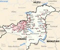
File:Maubisse posto administrativo.png
外觀

預覽大小:720 × 599 像素。 其他解析度:288 × 240 像素 | 577 × 480 像素 | 882 × 734 像素。
原始檔案 (882 × 734 像素,檔案大小:624 KB,MIME 類型:image/png)
檔案歷史
點選日期/時間以檢視該時間的檔案版本。
| 日期/時間 | 縮圖 | 尺寸 | 用戶 | 備註 | |
|---|---|---|---|---|---|
| 目前 | 2012年3月12日 (一) 17:56 |  | 882 × 734(624 KB) | J. Patrick Fischer | River Aicocai added |
| 2010年6月20日 (日) 12:56 |  | 882 × 734(315 KB) | J. Patrick Fischer | typo: Caimauk -> Caimauc | |
| 2009年12月1日 (二) 20:57 |  | 882 × 734(273 KB) | J. Patrick Fischer | New geographical names and spelling according Ministerial Document 199/2009, http://www.jornal.gov.tl/public/docs/2009/serie_1/serie1_no33.pdf | |
| 2009年11月6日 (五) 12:32 |  | 882 × 734(269 KB) | J. Patrick Fischer | Some Village names were missing | |
| 2009年10月13日 (二) 08:58 |  | 882 × 734(263 KB) | J. Patrick Fischer | {{Information |Description={{en|1=The subdistrict of Maubisse, district Ainaro, East Timor}} {{de|1=Subdistrikt Maubisse, Distrikt Ainaro, Osttimor}} |Source=Eigenes Werk unter Verwendung von [[:File:Administrative map of the Ainaro district of East Timor |
檔案用途
全域檔案使用狀況
以下其他 wiki 使用了這個檔案:
- de.wikipedia.org 的使用狀況
- de.wikivoyage.org 的使用狀況
- el.wikipedia.org 的使用狀況
- en.wikipedia.org 的使用狀況
- pl.wikipedia.org 的使用狀況
- tet.wikipedia.org 的使用狀況
- ur.wikipedia.org 的使用狀況
- www.wikidata.org 的使用狀況

