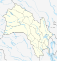
File:Norway Buskerud adm location map.svg
外觀

此 SVG 檔案的 PNG 預覽的大小:568 × 600 像素。 其他解析度:227 × 240 像素 | 455 × 480 像素 | 727 × 768 像素 | 970 × 1,024 像素 | 1,940 × 2,048 像素 | 966 × 1,020 像素。
原始檔案 (SVG 檔案,表面大小:966 × 1,020 像素,檔案大小:109 KB)
檔案歷史
點選日期/時間以檢視該時間的檔案版本。
| 日期/時間 | 縮圖 | 尺寸 | 用戶 | 備註 | |
|---|---|---|---|---|---|
| 目前 | 2024年5月19日 (日) 18:13 |  | 966 × 1,020(109 KB) | NordNordWest | corr |
| 2023年12月2日 (六) 20:48 |  | 966 × 1,020(106 KB) | NordNordWest | corr | |
| 2023年7月22日 (六) 19:13 |  | 966 × 1,020(111 KB) | NordNordWest | == {{int:filedesc}} == {{Information |Description= {{de|1=Positionskarte von Buskerud, Norwegen}} {{en|1=Location map of Buskerud, Norway}} {{Location map series N |stretching=200 |top=61.2 |bottom=59.3 |left=7.3 |right=10.9 }} |Source={{Own using}} United States National Imagery and Mapping Agency data |Date=2023-07-22 |Author={{U|NordNordWest}} |Permission= |other_versions= }} {{Kartenwerkstatt}} == {{int:license-header}} == {{User:NordNordWest/LicenceMap}} [[Category:Location maps of Eur... |
檔案用途
下列2個頁面有用到此檔案:
全域檔案使用狀況
以下其他 wiki 使用了這個檔案:
- bg.wikipedia.org 的使用狀況
- de.wikipedia.org 的使用狀況
- en.wikipedia.org 的使用狀況
- Svelvik
- Hønefoss
- Numedal
- Hallingdal
- Eiker
- Konnerud
- Vassfaret
- Vikersund
- Skoger
- Øvre Sandsvær
- Gulskogen Station
- Module:Location map/data/Norway Buskerud/doc
- Hønefoss Church
- Bragernes Church
- Vidalen
- Kongsberg Church
- 2013 Norwegian Third Division
- Lågendalen
- Sollihøgda Chapel
- Module:Location map/data/Norway Buskerud
- List of Eliteserien clubs
- Kongsberg attack
- eo.wikipedia.org 的使用狀況
- es.wikipedia.org 的使用狀況
- fi.wikipedia.org 的使用狀況
- fr.wikipedia.org 的使用狀況
檢視此檔案的更多全域使用狀況。


