
File:Nuclear plants map France.jpg
預覽大小:626 × 600 像素。 其他解析度:250 × 240 像素 | 501 × 480 像素 | 801 × 768 像素 | 1,200 × 1,150 像素。
原始檔案 (1,200 × 1,150 像素,檔案大小:740 KB,MIME 類型:image/jpeg)
摘要
| 描述 |
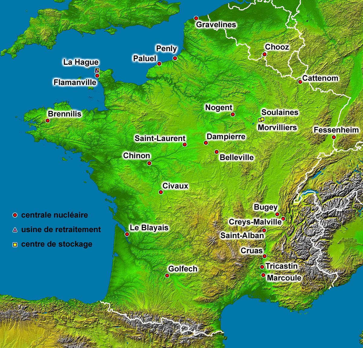
English: Map of the French nuclear power plants (in French).
Français : Carte en français des centrales nucléaires, usines de retraitement et centres de stockage français. |
| 日期 | |
| 來源 | Background map : Image:France_radar_2.jpg, a modified version from the NASA Earth Observatory |
| 作者 | Eric Gaba (Sting - fr:Sting) |
| 授權許可 (重用此檔案) |
Public domain |
| 其他版本 |
|

授權條款
| 本作品由NASA創作,屬於公有領域。根據NASA的版權政策:“NASA的創作除非另有聲明否則不受版權保護。”(參見:Template:PD-USGov/zh,NASA版權政策或JPL圖像使用政策) | ||
 |
警告:
|
| This work was previously under Public Domain, or a Free License. It has been digitally enhanced and/or modified. This derivative work has been (or is hereby) released into the public domain by its author, Sting at the French Wikipedia project. This applies worldwide. 在一些國家這可能不合法;如果是這樣的話,那麼:
|
檔案歷史
點選日期/時間以檢視該時間的檔案版本。
| 日期/時間 | 縮圖 | 尺寸 | 用戶 | 備註 | |
|---|---|---|---|---|---|
| 目前 | 2006年9月1日 (五) 14:35 | | 1,200 × 1,150(740 KB) | Sting | Lightning effect around names enhanced |
| 2006年8月30日 (三) 05:49 |  | 1,200 × 1,150(709 KB) | Sting | {{Information |Description=Map of the French nuclear power plants (in French) |Source=Background map : Image:France_radar_2.jpg, a modified version from the [http://earthobservatory.nasa.gov/Newsroom/NewImages/images.php3?img_id=15360 NASA Earth Obse |
檔案用途
下列頁面有用到此檔案:
全域檔案使用狀況
以下其他 wiki 使用了這個檔案:
- es.wikipedia.org 的使用狀況
- fr.wikipedia.org 的使用狀況