
File:PIA16227-MarsCuriosityRover-Rocknest-20121012.jpg

原始檔案 (7,703 × 2,198 像素,檔案大小:1.82 MB,MIME 類型:image/jpeg)
摘要
| 描述 |
English: 10.12.2012
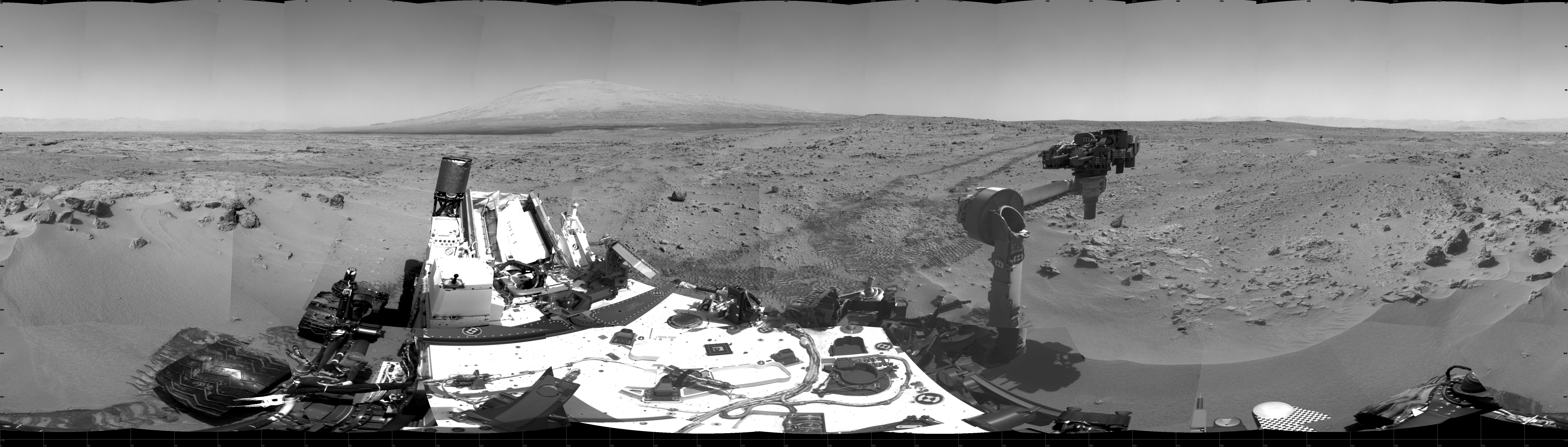
Curiosity's Location During First Scooping This 360-degree scene shows the surroundings of the location where NASA Mars rover Curiosity arrived on the 59th Martian day, or sol, of the rover's mission on Mars (Oct. 5, 2012). It is a mosaic of images taken by Curiosity's Navigation Camera (Navcam) on sols 59 and 60. Smooth surfaces of the windblown sand and dust of the "Rocknest" area, in the foreground, are what signaled from a distance that this might be an appropriate place to spend about three weeks collecting and using the mission's first few scoopfuls of soil. The rover scooped up its first sample on Sol 61 (Oct. 7, 2012). South is at the center of this panorama, north at both ends. Mount Sharp is on the horizon in the southeast. The "Glenelg" area planned as the next destination lies to the east. Tracks that Curiosity's wheels made while driving toward Rocknest recede toward the west. For scale, Curiosity leaves parallel tracks about 9 feet (2.7 meters) apart. The scene is presented here as a cylindrical projection. Image Credit: NASA/JPL-Caltech |
| 日期 | |
| 來源 | http://photojournal.jpl.nasa.gov/jpeg/PIA16227.jpg |
| 作者 | NASA/JPL-Caltech |
| 其他版本 | http://photojournal.jpl.nasa.gov/catalog/PIA16227 |
授權條款
| 本作品由NASA創作,屬於公有領域。根據NASA的版權政策:“NASA的創作除非另有聲明否則不受版權保護。”(參見:Template:PD-USGov/zh,NASA版權政策或JPL圖像使用政策) | ||
 |
警告:
|
檔案歷史
點選日期/時間以檢視該時間的檔案版本。
| 日期/時間 | 縮圖 | 尺寸 | 用戶 | 備註 | |
|---|---|---|---|---|---|
| 目前 | 2012年10月13日 (六) 14:40 | 7,703 × 2,198(1.82 MB) | Drbogdan | User created page with UploadWizard |
檔案用途
下列頁面有用到此檔案:
全域檔案使用狀況
以下其他 wiki 使用了這個檔案:
- fr.wikipedia.org 的使用狀況
- uk.wikipedia.org 的使用狀況