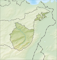
File:Reliefkarte Appenzell Innerrhoden blank.png
外觀

預覽大小:569 × 600 像素。 其他解析度:228 × 240 像素 | 455 × 480 像素 | 922 × 972 像素。
原始檔案 (922 × 972 像素,檔案大小:869 KB,MIME 類型:image/png)
檔案歷史
點選日期/時間以檢視該時間的檔案版本。
| 日期/時間 | 縮圖 | 尺寸 | 用戶 | 備註 | |
|---|---|---|---|---|---|
| 目前 | 2013年12月5日 (四) 11:53 |  | 922 × 972(869 KB) | Tschubby | {{Information |Description= {{de| Reliefkarte des Kantons Appenzell Innerrhoden}} Topographischer Hintergrund: [http://www2.jpl.nasa.gov/srtm NASA Shuttle Radar Topography Mission] (public domain). SRTM3 v.2. |Source={{own}} |Date= 2013-12-05 |Author=... |
檔案用途
全域檔案使用狀況
以下其他 wiki 使用了這個檔案:
- de.wikipedia.org 的使用狀況
- Hundwiler Höhi
- Ruppenpass
- Sämtisersee
- Ebenalp
- Liste von Burgen und Schlössern in der Schweiz
- Schäfler
- Ruine Clanx
- Wikipedia:Kartenwerkstatt/Positionskarten/Europa
- Marwees
- Hundstein (Alpstein)
- Freiheit (Berg)
- Widderalpstöck
- Fänerenspitz
- Hochhus
- Hüser (Berg)
- Chlosterspitz
- Vorlage:Positionskarte Schweiz Appenzell Innerrhoden
- Alp Sigel
- Mettlenbrücke
- Öhrli
- Nasenlöcher (Berg)
- Benutzer:Tschubby/Reliefkarten
- en.wikipedia.org 的使用狀況
- eo.wikipedia.org 的使用狀況
- Ŝablono:Situo sur mapo Svislando Apencelo Interna
- Appenzell (stacidomo)
- Gonten (stacidomo)
- Gontenbad (stacidomo)
- Gonten Alpsteinblick (stacidomo)
- Jakobsbad (stacidomo)
- Wasserauen (stacidomo)
- Schwende (stacidomo)
- Weissbad (stacidomo)
- Steinegg (stacidomo)
- Hirschberg (stacidomo)
- Sammelplatz (stacidomo)
- fr.wikipedia.org 的使用狀況
- Säntis
- Modèle:Géolocalisation/Canton d'Appenzell Rhodes-Intérieures
- Projet:Cartographie/Géolocalisation/Maintenance/Images des cantons suisses
- Altmann (Préalpes appenzelloises)
- Utilisateur:Wikisoft*/Projet:Cartographie/Géolocalisation/Maintenance/Images des cantons suisses
- Projet:Cartographie/Cartes standards/Suisse
- Modèle:Géolocdual/Canton d'Appenzell Rhodes-Intérieures
- Hoher Kasten
檢視此檔案的更多全域使用狀況。


