
File:Rhodes NLT Landsat7.png
預覽大小:605 × 600 像素。 其他解析度:242 × 240 像素 | 484 × 480 像素 | 775 × 768 像素 | 1,033 × 1,024 像素 | 1,948 × 1,931 像素。
原始檔案 (1,948 × 1,931 像素,檔案大小:5.65 MB,MIME 類型:image/png)
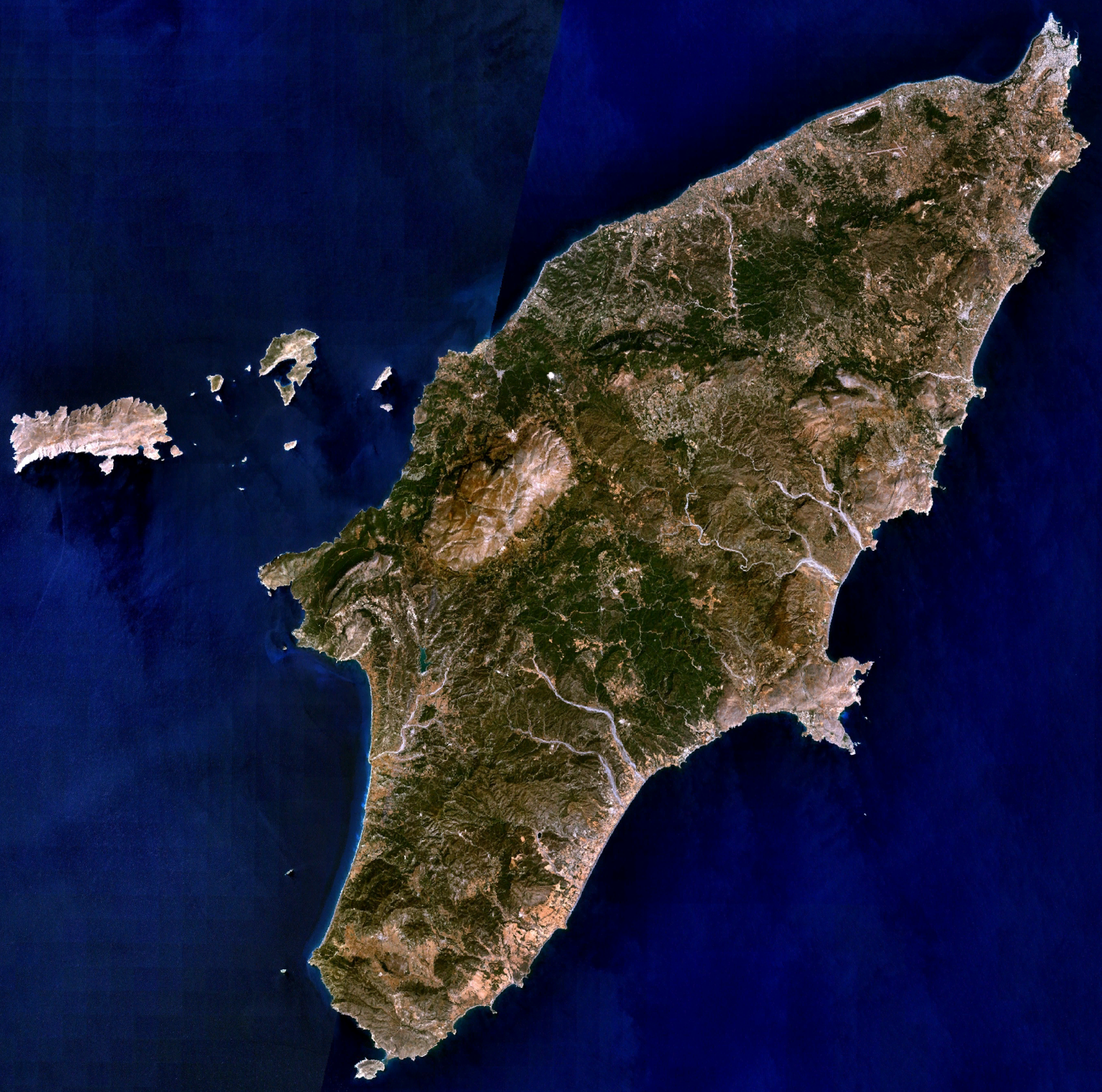
| 描述 | Visible colour satellite image of Rhodes. | |||
| 來源 |
Screenshot from NASA World Wind, NLT Landsat7 layer. Coordinates: worldwind://goto/world=Earth&lat=36.16654&lon=27.93315&alt=80698 |
|||
| 作者 | 相片: NASA | |||
| 授權許可 (重用此檔案) |
|
|||
| 其他版本 | Image:Rodas.png |

檔案歷史
點選日期/時間以檢視該時間的檔案版本。
| 日期/時間 | 縮圖 | 尺寸 | 用戶 | 備註 | |
|---|---|---|---|---|---|
| 目前 | 2006年4月16日 (日) 20:29 | | 1,948 × 1,931(5.65 MB) | Hautala | {{Information| |Description=Visible colour satellite image of Rhodes. |Source=Screenshot from NASA World Wind, NLT Landsat7 layer. |Date= |Author= |Permission={{PD-WorldWind}} |other_versions= }} |
檔案用途
全域檔案使用狀況
以下其他 wiki 使用了這個檔案:
- ab.wikipedia.org 的使用狀況
- als.wikipedia.org 的使用狀況
- an.wikipedia.org 的使用狀況
- ar.wikipedia.org 的使用狀況
- az.wikipedia.org 的使用狀況
- be-tarask.wikipedia.org 的使用狀況
- be.wikipedia.org 的使用狀況
- bg.wikipedia.org 的使用狀況
- ca.wikipedia.org 的使用狀況
- ceb.wikipedia.org 的使用狀況
- cs.wikipedia.org 的使用狀況
- da.wikipedia.org 的使用狀況
- de.wikipedia.org 的使用狀況
- el.wikipedia.org 的使用狀況
- en.wikipedia.org 的使用狀況
- eu.wikipedia.org 的使用狀況
- fi.wikipedia.org 的使用狀況
- fr.wikipedia.org 的使用狀況
檢視此檔案的更多全域使用狀況。