File:Roman Empire 125 political map.png

頁面內容不支援其他語言。
這個檔案來自維基共享資源
維基百科,自由的百科全書

原始檔案(2,186 × 1,817 像素,檔案大小:3.21 MB,MIME 類型:image/png


拍攝地點45° 00′ 00″ 北, 20° 00′ 00″ 東 Kartographer map based on OpenStreetMap.位於此地的本圖片與其他圖片: OpenStreetMapinfo

摘要

描述
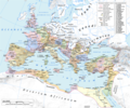
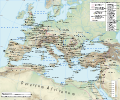
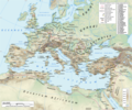
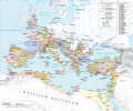
English: Map of the Roman Empire in 125 during the reign of emperor Hadrian.

Projection

Lambert azimuthal-equal area. Central latitude: 45° N, central longitude: 20° E. X, Y origin offset - 0

Datum: ETRS89

Sources

The physical map was made using the following public domain sources:

Additional references for the map content:

  • Tacitus, Germania (ca. 100)
  • Ptolemy, Geographia (ca. 140)
  • Atlante storico DeAgostini, Instituto Geografico DeAgostini, 1998. pg. 35-41.
  • Historischer Weltatlas, Dr. Walter Leisering, Marix Verlag, 2011. pg. 26-27
  • Történelmi világatlasz, Cartographia Kiadó, 2005. pg. 20-21.
  • The Penguin Historical Atlas of Ancient Rome by Christopher Scarre, Penguin Historical Atlases, 1995. pg. 81.

Software used

GIS:

Graphics editors:

日期
來源 自己的作品
作者 User:Andrein, with the assistance of EraNavigator
授權許可
(重用此檔案)
Any use of this map can be made as long as you credit me (Andrei N. – Wikimedia Commons user: Andrein) as the author and distribute the copies and derivative works under the same license as that the one stated below.
其他版本

[編輯]

File:Roman Empire 125 political map.svg是本檔案的向量版本。 如果品質不低,就應該優先使用該檔案,而非PNG檔案。

File:Roman Empire 125 political map.png → File:Roman Empire 125 political map.svg

更多資訊請參閱Help:SVG/zh

其他語言
Alemannisch  Bahasa Indonesia  Bahasa Melayu  British English  català  čeština  dansk  Deutsch  eesti  English  español  Esperanto  euskara  français  Frysk  galego  hrvatski  Ido  italiano  lietuvių  magyar  Nederlands  norsk bokmål  norsk nynorsk  occitan  Plattdüütsch  polski  português  português do Brasil  română  Scots  sicilianu  slovenčina  slovenščina  suomi  svenska  Tiếng Việt  Türkçe  vèneto  Ελληνικά  беларуская (тарашкевіца)  български  македонски  нохчийн  русский  српски / srpski  татарча/tatarça  українська  ქართული  հայերեն  বাংলা  தமிழ்  മലയാളം  ไทย  한국어  日本語  简体中文  繁體中文  עברית  العربية  فارسی  +/−
新SVG圖片

General map
Political map

授權條款

我,本作品的著作權持有者,決定用以下授權條款發佈本作品:
w:zh:共享創意
姓名標示 相同方式分享
您可以自由:
  • 分享 – 複製、發佈和傳播本作品
  • 重新修改 – 創作演繹作品
惟需遵照下列條件:
  • 姓名標示 – 您必須指名出正確的製作者,和提供授權條款的連結,以及表示是否有對內容上做出變更。您可以用任何合理的方式來行動,但不得以任何方式表明授權條款是對您許可或是由您所使用。
  • 相同方式分享 – 如果您利用本素材進行再混合、轉換或創作,您必須基於如同原先的相同或兼容的條款,來分布您的貢獻成品。
GNU head 已授權您依據自由軟體基金會發行的無固定段落、封面文字和封底文字GNU自由文件授權條款1.2版或任意後續版本,對本檔進行複製、傳播和/或修改。該協議的副本列在GNU自由文件授權條款中。
您可以選擇您需要的授權條款。
Maps of the history of Europe
BCE
aC

Weichselian ice age (c. 113,000–9700) · Neolithic expansion (c. 7000–4500) · Middle Neolithic (c. 4500–4000) · Late Neolithic (c. 4000–3000) · Copper Age – Corded Ware culture (c. 2900–2350) · Copper Age – Bellbeaker culture (c. 2800–1800) · Early Bronze Age – Unetice culture (c. 2300–1600) · Late Bronze Age – Urnfield culture (c. 1300—750) · Migrations (c. 1000–100) · Hallstatt & La Tène cultures (c. 800–100) · Roman Republic (510–40) · 220 · 218 · 200 · 201–100 · 58 · 49 · 39 · 30 BCE–6 CE


CE
dC

14 · 14–37 · 60 · 60 · 69 · 80 · Migrations 100–500 · 117 · 117 · 125 · Migrations 150–774 · Economy 180 · 271 · 293–305 · 337 · 395 · c. 395 · 400 · 400 · 450 · 457–61 · 476 · 480 · Franks 481–814 · Early Slavs 500–700 · 500 · 526 · 526–600 · Christianisation to 600 · c. 550 · 650 · Pontic Steppe 650 · 665 · 800 · Vikings 800–1050 · 814 · 843–70 · 850 · 900 · 912 · 998 · 1000 · 1000 · 1054 · 1092 · First Crusade 1095–99 · 1097 · 1135 · 1142 · 1147–49 · 1190 · 1190 · 1250 · c. 1250 · 1301-1400 · 1301-1400 · 1328 · 1345 · Black Plague 1347–51 · 1360 · 1400 · Trade routes c. 1400 · 1430 · 1470 · 1490 · 1492 · 1500 · 1519 · 1550 · 1560 · Religion 1560 · Religion 1600 · Religion 1618 · 1618–48 · 1648 · 1683 · 1700 · 1701 · 1708 · 1714 · 1721 · 1725–30 · 1739–1740 · 1740 · 1748–66 · 1783–1792 · 1787 · 1787 · 1789 · 1799 · 1812 · 1812 · 1812 · 1812 · 1813 · 1815 · 1815 · 1815 · 1818 · Ottoman Empire 1830–1923 · 1848–49 · 1861 · 1867 · 1871 · 1878 · 1890 · 1905 · 1911 · 1914 · 1914 · 1919 · 1919–29 · 1923 · 1929 · 1930 · 1940 · 1941–42 · 1942–45 · Cold War 1947–91 · 1950 · 1993–2006 · 2006 to date

(this template: · view · discuss )

說明

添加單行說明來描述出檔案所代表的內容
te

在此檔案描寫的項目

描繪內容

創作作者 Chinese (Hong Kong) (已轉換拼寫)

沒有維基數據項目的某些值

作者姓名字串 繁體中文 (已轉換拼寫):​EraNavigator
維基媒體使用者名稱 繁體中文 (已轉換拼寫):​EraNavigator

著作權狀態 繁體中文 (已轉換拼寫)

有著作權 繁體中文 (已轉換拼寫)

GNU自由文檔許可證1.2或更高版本 繁體中文 (已轉換拼寫)

共享創意署名-相同方式共享3.0Unported Chinese (Hong Kong) (已轉換拼寫)

檔案來源 Chinese (Taiwan) (已轉換拼寫)

上傳者的原創作品 繁體中文 (已轉換拼寫)

視角坐標 繁體中文 (已轉換拼寫)

45°0'0.000"N, 20°0'0.000"E

檔案歷史

點選日期/時間以檢視該時間的檔案版本。

最新 | 最早) 檢視(較新 10 筆 | )(10 | 20 | 50 | 100 | 250 | 500
日期/時間縮⁠圖尺寸用戶備⁠註
目前2015年7月20日 (一) 18:14於 2015年7月20日 (一) 18:14 版本的縮圖2,186 × 1,817(3.21 MB)ArdadN1
2015年7月20日 (一) 17:49於 2015年7月20日 (一) 17:49 版本的縮圖2,186 × 1,817(3.21 MB)ArdadN1
2015年3月3日 (二) 18:46於 2015年3月3日 (二) 18:46 版本的縮圖2,186 × 1,817(3.21 MB)ArdadNfixing text problems
2015年3月3日 (二) 17:05於 2015年3月3日 (二) 17:05 版本的縮圖2,186 × 1,817(3.18 MB)ArdadNnew road added
2015年2月10日 (二) 13:50於 2015年2月10日 (二) 13:50 版本的縮圖2,186 × 1,817(3.21 MB)ArdadN1
2014年5月20日 (二) 18:44於 2014年5月20日 (二) 18:44 版本的縮圖2,186 × 1,817(3.2 MB)ArdadN1
2014年4月9日 (三) 18:19於 2014年4月9日 (三) 18:19 版本的縮圖2,186 × 1,817(3.2 MB)ArdadNScotti
2014年4月4日 (五) 19:26於 2014年4月4日 (五) 19:26 版本的縮圖2,186 × 1,817(3.2 MB)ArdadN1
2014年3月30日 (日) 11:47於 2014年3月30日 (日) 11:47 版本的縮圖2,186 × 1,817(3.19 MB)ArdadNremoved Scotti, other minor edits
2013年5月12日 (日) 14:27於 2013年5月12日 (日) 14:27 版本的縮圖2,186 × 1,817(3.21 MB)ArdadN1
最新 | 最早) 檢視(較新 10 筆 | )(10 | 20 | 50 | 100 | 250 | 500

沒有使用此檔案的頁面。

全域檔案使用狀況

以下其他 wiki 使用了這個檔案:

詮釋資料