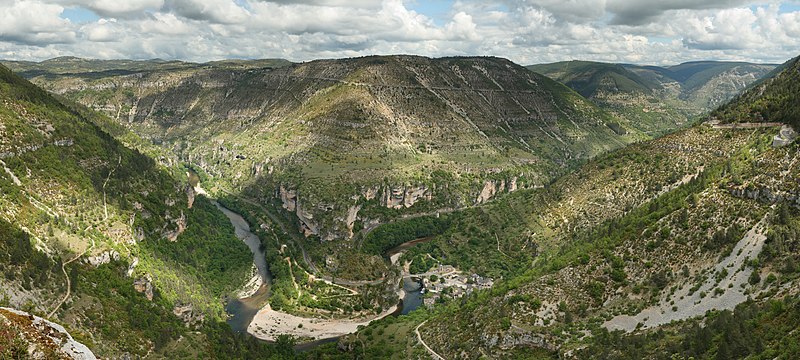
File:Saint Chely Tarn.jpg
外觀

預覽大小:800 × 360 像素。 其他解析度:320 × 144 像素 | 640 × 288 像素 | 1,024 × 461 像素 | 1,280 × 577 像素 | 2,560 × 1,153 像素 | 6,609 × 2,977 像素。
原始檔案 (6,609 × 2,977 像素,檔案大小:13.36 MB,MIME 類型:image/jpeg)
檔案歷史
點選日期/時間以檢視該時間的檔案版本。
| 日期/時間 | 縮圖 | 尺寸 | 用戶 | 備註 | |
|---|---|---|---|---|---|
| 目前 | 2008年8月12日 (二) 18:12 |  | 6,609 × 2,977(13.36 MB) | Benh | Changed colors. I believe this is more true to what I saw. |
| 2008年6月7日 (六) 22:56 |  | 6,609 × 2,970(9.59 MB) | Benh | {{Information |Description={{en|1=View over the cirque of Pougnadoire and Saint-Chély of Tarn village, in the Tarn Gorges, from the cirque of Saint-Chély. This picture features the road D 907bis which goes alongside the Tarn river all along the gorges.} |
檔案用途
下列3個頁面有用到此檔案:
全域檔案使用狀況
以下其他 wiki 使用了這個檔案:
- ar.wikipedia.org 的使用狀況
- az.wikipedia.org 的使用狀況
- bn.wikipedia.org 的使用狀況
- ceb.wikipedia.org 的使用狀況
- crh.wikipedia.org 的使用狀況
- cs.wikipedia.org 的使用狀況
- cv.wikipedia.org 的使用狀況
- de.wikipedia.org 的使用狀況
- de.wikivoyage.org 的使用狀況
- el.wikipedia.org 的使用狀況
- en.wikipedia.org 的使用狀況
- Lozère
- Massif Central
- Wikipedia:Featured pictures/Places/Panorama
- User talk:Blieusong
- Wikipedia:Featured pictures thumbs/12
- Wikipedia:Picture peer review/Archives/Apr-Jun 2008
- Saint-Chély-du-Tarn
- Wikipedia:Picture peer review/Saint Chely Tarn
- Wikipedia:Featured picture candidates/Saint Chely Tarn
- Wikipedia:Featured picture candidates/July-2008
- Wikipedia:Wikipedia Signpost/2008-07-07/Features and admins
- Wikipedia:Wikipedia Signpost/2008-07-07/SPV
- Wikipedia:Picture of the day/December 2008
- Template:POTD/2008-12-27
- Portal:Roads/Selected panorama
- Portal:Roads/Selected panorama/8
- User talk:Mostlyharmless/Archive 2
- Wikipedia:Wikipedia Signpost/Single/2008-07-07
- eo.wikipedia.org 的使用狀況
- es.wikipedia.org 的使用狀況
- fr.wikipedia.org 的使用狀況
檢視此檔案的更多全域使用狀況。


