
File:South Korea Ulsan adm location map.svg

此 SVG 檔案的 PNG 預覽的大小:600 × 600 像素。 其他解析度:240 × 240 像素 | 480 × 480 像素 | 768 × 768 像素 | 1,024 × 1,024 像素 | 2,048 × 2,048 像素 | 1,038 × 1,038 像素。
原始檔案 (SVG 檔案,表面大小:1,038 × 1,038 像素,檔案大小:159 KB)
摘要
| 描述 |
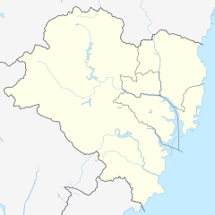
Deutsch: Positionskarte von Ulsan, Südkorea
English: Location map of Ulsan, South Korea
|
||||||||||||
| 日期 | |||||||||||||
| 來源 |
個人作品,使用: |
||||||||||||
| 作者 | NordNordWest and OpenStreetMap contributors | ||||||||||||

|
|
授權條款
此檔案採用共享創意 姓名標示-相同方式分享 2.0 通用版授權條款。
- 您可以自由:
- 分享 – 複製、發佈和傳播本作品
- 重新修改 – 創作演繹作品
- 惟需遵照下列條件:
- 姓名標示 – 您必須指名出正確的製作者,和提供授權條款的連結,以及表示是否有對內容上做出變更。您可以用任何合理的方式來行動,但不得以任何方式表明授權條款是對您許可或是由您所使用。
- 相同方式分享 – 如果您利用本素材進行再混合、轉換或創作,您必須基於如同原先的相同或兼容的條款,來分布您的貢獻成品。
檔案歷史
點選日期/時間以檢視該時間的檔案版本。
| 日期/時間 | 縮圖 | 尺寸 | 用戶 | 備註 | |
|---|---|---|---|---|---|
| 目前 | 2019年8月27日 (二) 18:28 | | 1,038 × 1,038(159 KB) | NordNordWest | == {{int:filedesc}} == {{Information |Description= {{de|1=Positionskarte von Ulsan, Südkorea}} {{en|1=Location map of Ulsan, South Korea}} {{Location map series N |stretching=– |top=35.7376583 |bottom=35.3130416 |left=128.9607861 |right=129.4840972}} |Source={{Own using}} * [http://www.openstreetmap.org OpenStreetMap] |Date=2019-08-27 |Author={{U|NordNordWest}} and OpenStreetMap contributors |Permission= |other_versions= }} {{Kartenwerkstatt}} == {{int:license-header}} == {{Cc-by-sa-2.0}} [... |
檔案用途
下列頁面有用到此檔案:
全域檔案使用狀況
以下其他 wiki 使用了這個檔案:
- de.wikipedia.org 的使用狀況
- en.wikipedia.org 的使用狀況
- fr.wikipedia.org 的使用狀況
- he.wikipedia.org 的使用狀況
- ja.wikipedia.org 的使用狀況
- ko.wikipedia.org 的使用狀況
- pt.wikipedia.org 的使用狀況
- si.wikipedia.org 的使用狀況
- uz.wikipedia.org 的使用狀況