跳至內容

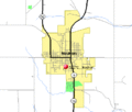
File:Waukon IA map.gif

頁面內容不支援其他語言。
這個檔案來自維基共享資源
維基百科,自由的百科全書

Waukon_IA_map.gif (422 × 359 像素,檔案大小:7 KB,MIME 類型:image/gif


摘要

描述
來源
作者

授權條款

Public domain
This image or file is a work of a United States Census Bureau employee, taken or made as part of that person's official duties. As a work of the U.S. federal government, the image is in the public domain.

English  español  日本語  македонски  മലയാളം  português do Brasil  русский  українська  עברית  +/−


原始上傳日誌

The original description page was here. All following user names refer to en.wikipedia.
  • 2007-04-05 23:08 Ace Telephone 422×359× (7107 bytes) http://tiger.census.gov/cgi-bin/mapsurfer?infact=2&outfact=2&act=move&on=statehwy&tlevel=-&tvar=-&tmeth=i&mlat=43.263951&mlon=-91.479994&msym=redpin&mlabel=52172__Waukon_&murl=&lat=43.27007&lon=-91.47824&wid=0.050&ht=0.050&conf=mapnew.con -- US Census Bur


說明

添加單行說明來描述出檔案所代表的內容

在此檔案描寫的項目

描繪內容

著作權狀態 繁體中文 (已轉換拼寫)

斷定方法:​美國聯邦政府的作品 繁體中文 (已轉換拼寫)

檔案歷史

點選日期/時間以檢視該時間的檔案版本。

日期/時間縮⁠圖尺寸用戶備⁠註
目前2013年8月24日 (六) 03:40於 2013年8月24日 (六) 03:40 版本的縮圖422 × 359(7 KB)Dcirovic{{Information |Description={{en|http://tiger.census.gov/cgi-bin/mapsurfer?infact=2&outfact=2&act=move&on=statehwy&tlevel=-&tvar=-&tmeth=i&mlat=43.263951&mlon=-91.479994&msym=redpin&mlabel=52172__Waukon_&murl=&lat=43.27007&lon=-91.47824&wid=0.050&ht=0.0...

下列頁面有用到此檔案:

全域檔案使用狀況

以下其他 wiki 使用了這個檔案: