
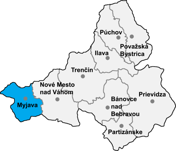
File:Okres myjava.png

本预览的尺寸:699 × 600像素。 其他分辨率:280 × 240像素 | 560 × 480像素 | 895 × 768像素 | 1,194 × 1,024像素 | 2,040 × 1,750像素。
原始文件 (2,040 × 1,750像素,文件大小:224 KB,MIME类型:image/png)
文件历史
点击某个日期/时间查看对应时刻的文件。
| 日期/时间 | 缩略图 | 大小 | 用户 | 备注 | |
|---|---|---|---|---|---|
| 当前 | 2007年1月8日 (一) 17:09 | | 2,040 × 1,750(224 KB) | Murli | {{Information |Description= |Source= |Date= |Author= |Permission=Own work, all rights released (Public domain) |other_versions= }} {{PD-self}} |
| 2007年1月7日 (日) 23:03 |  | 2,040 × 1,750(207 KB) | Murli | better version | |
| 2005年5月16日 (一) 20:13 |  | 241 × 215(10 KB) | Murli | *map of the Trenčín region (Trenčiansky kraj) in Slovakia, district (okres) of Myjava highlighted *selfprovided on September 19th, 2004 {{GFDL}} |
文件用途
以下页面使用本文件:
全域文件用途
以下其他wiki使用此文件:
- ar.wikipedia.org上的用途
- bg.wikipedia.org上的用途
- ca.wikipedia.org上的用途
- cs.wikipedia.org上的用途
- de.wikipedia.org上的用途
- eo.wikipedia.org上的用途
- es.wikipedia.org上的用途
- fr.wikipedia.org上的用途
- hr.wikipedia.org上的用途
- it.wikipedia.org上的用途
- ka.wikipedia.org上的用途
- ko.wikipedia.org上的用途
- la.wikipedia.org上的用途
- lmo.wikipedia.org上的用途
- lv.wikipedia.org上的用途
- ms.wikipedia.org上的用途
- nl.wikipedia.org上的用途
- pl.wikipedia.org上的用途
- pt.wikipedia.org上的用途
- ro.wikipedia.org上的用途
- ru.wikipedia.org上的用途
- sh.wikipedia.org上的用途
- sk.wikipedia.org上的用途
- sr.wikipedia.org上的用途
- tr.wikipedia.org上的用途
- uk.wikipedia.org上的用途
- www.wikidata.org上的用途
- zh-min-nan.wikipedia.org上的用途