File:FRP-Map4.png
外观
FRP-Map4.png (290 × 290像素,文件大小:5 KB,MIME类型:image/png)
文件历史
点击某个日期/时间查看对应时刻的文件。
| 日期/时间 | 缩略图 | 大小 | 用户 | 备注 | |
|---|---|---|---|---|---|
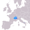
| 当前 | 2011年9月18日 (日) 20:34 |  | 290 × 290(5 KB) | Davius | Area of Faeto and Celle di San Vito (South Italy), correctly relocated to the West. |
| 2011年9月18日 (日) 20:30 |  | 290 × 290(5 KB) | Davius | Area of Faeto and Celle di San Vito (South Italy) correctly relocated to the West. | |
| 2007年3月17日 (六) 10:16 |  | 290 × 290(6 KB) | SieBot | {{Information |Description=Franco-Provençal taalgebied kaart, gemaakt voor Wikipedia van: BlankMap-Europe.png, gevonden op Wikipedia Commons - GDFL |Source=Originally from [http://nl.wikipedia.org nl.wikipedia]; description page is/was [http://nl.wikipe |
文件用途
以下3个页面使用本文件:
全域文件用途
以下其他wiki使用此文件:
- af.wikipedia.org上的用途
- als.wikipedia.org上的用途
- am.wikipedia.org上的用途
- an.wikipedia.org上的用途
- ast.wikipedia.org上的用途
- br.wikipedia.org上的用途
- ca.wikipedia.org上的用途
- ca.wiktionary.org上的用途
- cy.wikipedia.org上的用途
- en.wikipedia.org上的用途
- eo.wikipedia.org上的用途
- es.wikipedia.org上的用途
- eu.wikipedia.org上的用途
- fa.wikipedia.org上的用途
- fi.wikipedia.org上的用途
- frp.wikipedia.org上的用途
- frr.wikipedia.org上的用途
- fr.wikipedia.org上的用途
- fr.wikivoyage.org上的用途
- gl.wikipedia.org上的用途
- gv.wikipedia.org上的用途
- he.wikipedia.org上的用途
- hif.wikipedia.org上的用途
- hu.wikipedia.org上的用途
- id.wikipedia.org上的用途
- incubator.wikimedia.org上的用途
- io.wikipedia.org上的用途
- it.wikipedia.org上的用途
- jam.wikipedia.org上的用途
- ja.wikipedia.org上的用途
- ka.wikipedia.org上的用途
- ko.wikipedia.org上的用途
- lij.wikipedia.org上的用途
- lv.wikipedia.org上的用途
- nl.wikipedia.org上的用途
- oc.wikipedia.org上的用途
查看此文件的更多全域用途。

