
File:Am Chüebodensee bei Elm.jpg
預覽大小:800 × 537 像素。 其他解析度:320 × 215 像素 | 640 × 429 像素 | 1,024 × 687 像素 | 1,280 × 859 像素 | 2,560 × 1,717 像素 | 3,852 × 2,584 像素。
原始檔案 (3,852 × 2,584 像素,檔案大小:5.82 MB,MIME 類型:image/jpeg)
| 描述 |
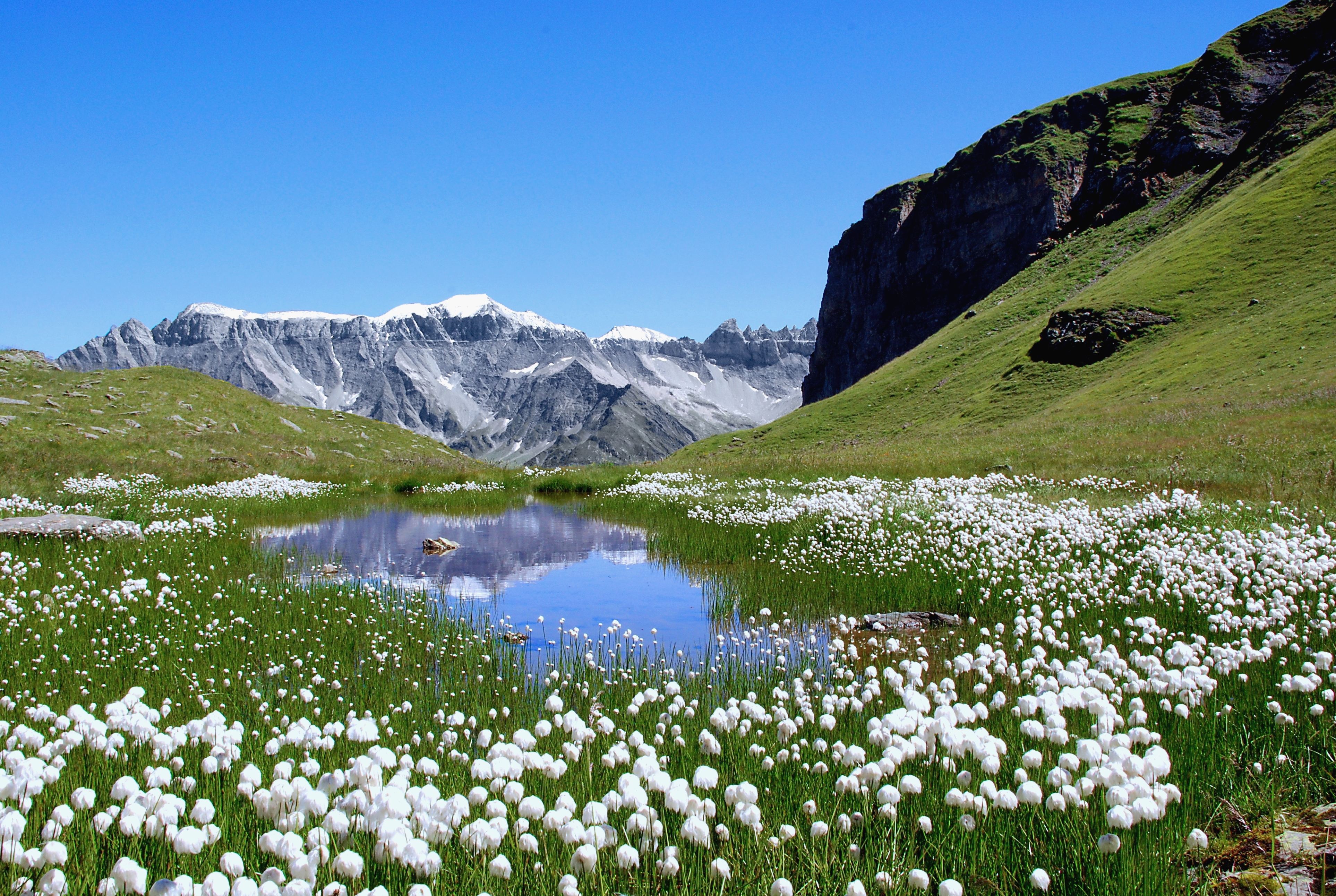
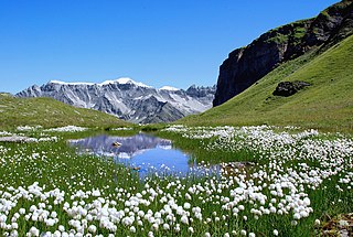
Deutsch: Der von Wollgras gesäumte Ablauf des Chüebodensees oberhalb von Elm, Kanton Glarus. Blick auf den Piz Sardona (3056m) und rechts davon auf die Tschingelhoren (2849 m).
English: The outflow of the Chüebodensee close to Elm, Kanton Glarus. The niveous mountain is the Piz Sardona (3056m) and the peaks on the right, just before the rock spur blocks the sight are the Tschingelhoren (2849 m). |
| 日期 | |
| 來源 | 自己的作品 |
| 作者 | Matthias Zepper |
| 授權許可 (重用此檔案) |
我,本作品的著作權持有者,決定用以下授權條款發佈本作品: 此檔案採用創用CC 姓名標示-相同方式分享 3.0 未在地化版本授權條款。
|
| 拍攝地點 | | 位於此地的本圖片與其他圖片: OpenStreetMap |
|---|
檔案歷史
點選日期/時間以檢視該時間的檔案版本。
| 日期/時間 | 縮圖 | 尺寸 | 使用者 | 備註 | |
|---|---|---|---|---|---|
| 目前 | 2011年9月20日 (二) 10:54 | | 3,852 × 2,584(5.82 MB) | Curnen | Original file was unedited. This version is edited, especially the sharpness was increased. |
| 2007年10月7日 (日) 12:14 |  | 2,896 × 1,944(1.33 MB) | Curnen | {{Information |Description= Am Chüebodensee oberhalb von Elm, Kanton Glarus. Blick auf den Piz Segnes (3099m)und rechts davon auf die Tschingelhoren (2849 m).<br />At the Chüebodensee close to Elm, Kanton Glarus. The niveous mountain is the Piz Segnes ( |
檔案用途
下列頁面有用到此檔案:
全域檔案使用狀況
以下其他 wiki 使用了這個檔案:
- de.wikipedia.org 的使用狀況
- en.wikipedia.org 的使用狀況
- es.wikipedia.org 的使用狀況
- hr.wikipedia.org 的使用狀況
- hy.wikipedia.org 的使用狀況
- nn.wikipedia.org 的使用狀況
- pl.wikipedia.org 的使用狀況
- sh.wikipedia.org 的使用狀況
- vi.wikipedia.org 的使用狀況