
File:Argyle Cut.jpg
預覽大小:800 × 567 像素。 其他解析度:320 × 227 像素 | 640 × 454 像素 | 1,024 × 726 像素 | 1,121 × 795 像素。
原始檔案 (1,121 × 795 像素,檔案大小:52 KB,MIME 類型:image/jpeg)
摘要
| 描述 |
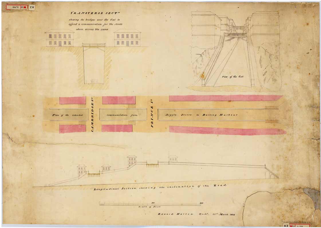
English: Transverse section showing the bridges over the [Argyle] Cut to afford a communication for the streets above, across the same, 22 March 1832
From the Surveyor General's Maps and plans. SRNSW: CGS 13859, [SZ 468]. This plan shows the bridges which were to be built over the Cut when it was completed. Convict labour was employed on the Argyle Cut which was made to give access from Sydney Cove to Miller's Point and Darling Harbour. Before the cut was excavated, pedestrians crossed the ridge by means of steps cut into the sandstone. The marks from the tools used in the operation remain as evidence of this feat of manual labour. The rock and rubble from the excavation was taken several hundred metres away to pack the mouth of the Tank Stream as a sea-wall at Circular Quay. http://www.records.nsw.gov.au/public/gallery/rocks/displays/displays-item-7.html |
| 日期 | |
| 來源 | http://www.records.nsw.gov.au/public/gallery/rocks/images/items/large/7.jpg |
| 作者 | From the Surveyor General's Maps and plans |
授權條款
此圖片或其他作品來自澳洲,因為其著作權保護期限到期,所以現在屬於公有領域。根據澳洲版權協會(ACC)和ACC資訊表格G023v19(版權期限)(2019年1月):1
使用此模板時,請提供有關圖片首次出版的位置和作者的資訊。 |
 | |||||||||||||||||||
檔案歷史
點選日期/時間以檢視該時間的檔案版本。
| 日期/時間 | 縮圖 | 尺寸 | 使用者 | 備註 | |
|---|---|---|---|---|---|
| 目前 | 2009年2月8日 (日) 23:15 | | 1,121 × 795(52 KB) | Macr | {{Information |Description={{en|1=Transverse section showing the bridges over the [Argyle] Cut to afford a communication for the streets above, across the same, 22 March 1832 From the Surveyor General's Maps and plans. SRNSW: CGS 13859, [SZ 468]. This p |
檔案用途
下列頁面有用到此檔案:
全域檔案使用狀況
以下其他 wiki 使用了這個檔案:
- en.wikipedia.org 的使用狀況
- ja.wikipedia.org 的使用狀況
- ms.wikipedia.org 的使用狀況