
File:Arizona ref 2001.jpg

預覽大小:506 × 599 像素。 其他解析度:203 × 240 像素 | 405 × 480 像素 | 677 × 802 像素。
原始檔案 (677 × 802 像素,檔案大小:283 KB,MIME 類型:image/jpeg)
| 描述 |
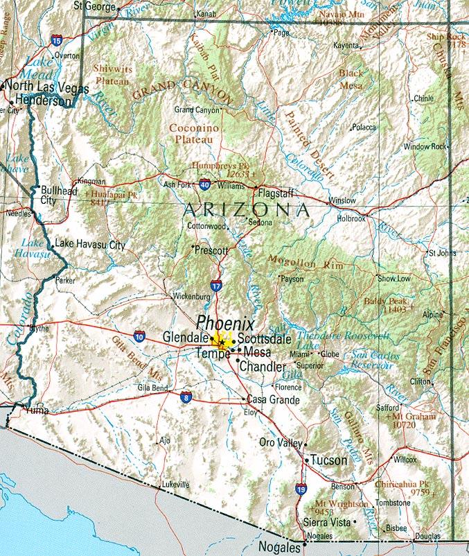
English: Map of Arizona. Shaded relief map with state boundaries, forest cover, place names, major highways. Portion of "The National Atlas of the United States of America. General Reference", compiled by U.S. Geological Survey 2001, printed 2002 |
|||
| 日期 | ||||
| 來源 | Courtesy of the University of Texas Libraries, The University of Texas at Austin | |||
| 作者 | U.S. Geological Survey 2001 | |||
| 授權許可 (重用此檔案) |
|
檔案歷史
點選日期/時間以檢視該時間的檔案版本。
| 日期/時間 | 縮圖 | 尺寸 | 使用者 | 備註 | |
|---|---|---|---|---|---|
| 目前 | 2006年1月22日 (日) 16:10 | | 677 × 802(283 KB) | Severino666~commonswiki | :''"Courtesy of the University of Texas Libraries, The The University of Texas at Austin.'' *'''Source:''' [http://en.wikipedia.org/wiki/Image:Texas_2002.jpg University of Texas Libraries] |
檔案用途
下列頁面有用到此檔案:
全域檔案使用狀況
以下其他 wiki 使用了這個檔案:
- de.wikipedia.org 的使用狀況
- en.wikipedia.org 的使用狀況
- hr.wiktionary.org 的使用狀況
- lt.wikipedia.org 的使用狀況
- pt.wikipedia.org 的使用狀況
- ro.wikipedia.org 的使用狀況