
File:Balkans in 9th century.jpg
預覽大小:800 × 567 像素。 其他解析度:320 × 227 像素 | 640 × 454 像素 | 1,024 × 726 像素 | 1,195 × 847 像素。
原始檔案 (1,195 × 847 像素,檔案大小:339 KB,MIME 類型:image/jpeg)
摘要
| 描述 |
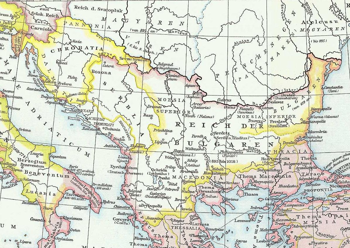
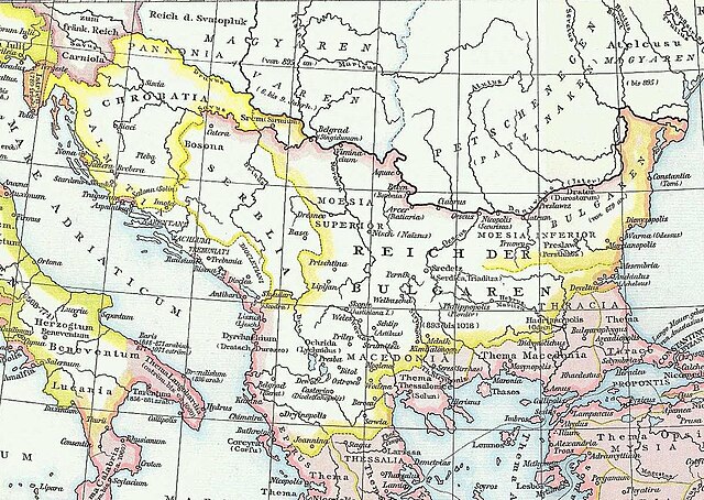
English: Map of the Balkans (part of Byzantine Empire) taken from G. Droysens Allgemeiner Historischer Handatlas, Verlag Velhagen und Klasing 1886 |
| 日期 | (UTC) |
| 來源 | G. Droysens Allgemeiner Historischer Handatlas, Verlag Velhagen und Klasing, Bielefeld / Leipzig 1886 |
| 作者 | Professor Gustav Droysen (Hg.), Professor G. Hertzberg (Zeichnung) |
| 授權許可 (重用此檔案) |
This image is in the public domain because its copyright has expired. |
授權條款
|
本作品在其來源國以及其他著作權期限是作者逝世後70年或以下的國家與地區屬於公有領域。 | |
| 此作品無已知的著作權限制,亦不受所有相關和鄰接的權利限制。 | |
原始上傳日誌
The original description page was here. All following user names refer to en.wikipedia.
- 2010-11-27 18:34 Kebeta 1195×847× (347463 bytes) {{Information |Description = Map of the Balkans (part of Byzantine Empire) taken from G. Droysens Allgemeiner Historischer Handatlas, Verlag Velhagen und Klasing 1886 |Source = G. Droysens Allgemeiner Historischer Handatlas, Verlag Velhagen u
檔案歷史
點選日期/時間以檢視該時間的檔案版本。
| 日期/時間 | 縮圖 | 尺寸 | 使用者 | 備註 | |
|---|---|---|---|---|---|
| 目前 | 2013年11月16日 (六) 15:40 | | 1,195 × 847(339 KB) | Diannaa | Full-size version from en.wiki |
| 2013年11月16日 (六) 09:00 |  | 800 × 567(191 KB) | Jbribeiro1 | {{Information |Description={{en|Map of the Balkans (part of Byzantine Empire) taken from G. Droysens Allgemeiner Historischer Handatlas, Verlag Velhagen und Klasing 1886}} |Source=Transferred from [http://en.wikipedia.org en.wikipedia]<br/> (Original t... |
檔案用途
下列2個頁面有用到此檔案:
全域檔案使用狀況
以下其他 wiki 使用了這個檔案:
- azb.wikipedia.org 的使用狀況
- cs.wikipedia.org 的使用狀況
- et.wikipedia.org 的使用狀況
- pt.wikipedia.org 的使用狀況
- sh.wikipedia.org 的使用狀況