
File:California Central Valley county map.svg

此 SVG 檔案的 PNG 預覽的大小:508 × 600 像素。 其他解析度:203 × 240 像素 | 407 × 480 像素 | 651 × 768 像素 | 867 × 1,024 像素 | 1,735 × 2,048 像素 | 621 × 733 像素。
原始檔案 (SVG 檔案,表面大小:621 × 733 像素,檔案大小:504 KB)
摘要
| 描述 |
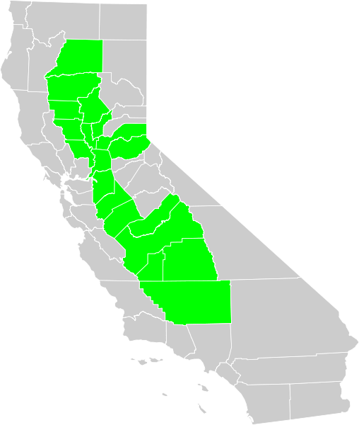
Political map of California displaying in green Central Valley of California counties.
|
| 日期 | |
| 來源 | 我個人以下列物件為基礎來創作: Blank California Map.svg |
| 作者 | Thadius856 |
| SVG開發 | 以及使用 Inkscape. |
授權條款
| 我,此作品的版權所有人,釋出此作品至公共領域。此授權條款在全世界均適用。 這可能在某些國家不合法,如果是的話: 我授予任何人有權利使用此作品於任何用途,除受法律約束外,不受任何限制。 |
檔案歷史
點選日期/時間以檢視該時間的檔案版本。
| 日期/時間 | 縮圖 | 尺寸 | 使用者 | 備註 | |
|---|---|---|---|---|---|
| 目前 | 2007年12月25日 (二) 01:48 | | 621 × 733(504 KB) | Thadius856 | {{Information |Description=Political map of California displaying Central Valley counties. Made from Census map in PD. Category:Maps of California |Source=Self-made. Inspired by Image:California CentralValley county map.png |Date= December 24, 2 |
檔案用途
下列頁面有用到此檔案:
全域檔案使用狀況
以下其他 wiki 使用了這個檔案:
- ast.wikipedia.org 的使用狀況
- ca.wikipedia.org 的使用狀況
- el.wikipedia.org 的使用狀況
- en.wikipedia.org 的使用狀況
- eo.wikipedia.org 的使用狀況
- eu.wikipedia.org 的使用狀況
- hu.wikipedia.org 的使用狀況
- jv.wikipedia.org 的使用狀況
- tr.wikipedia.org 的使用狀況
- vi.wikipedia.org 的使用狀況
- www.wikidata.org 的使用狀況