
File:Charcot Island, Antarctica.png
預覽大小:697 × 600 像素。 其他解析度:279 × 240 像素 | 558 × 480 像素 | 925 × 796 像素。
原始檔案 (925 × 796 像素,檔案大小:441 KB,MIME 類型:image/png)
摘要
| 描述 |
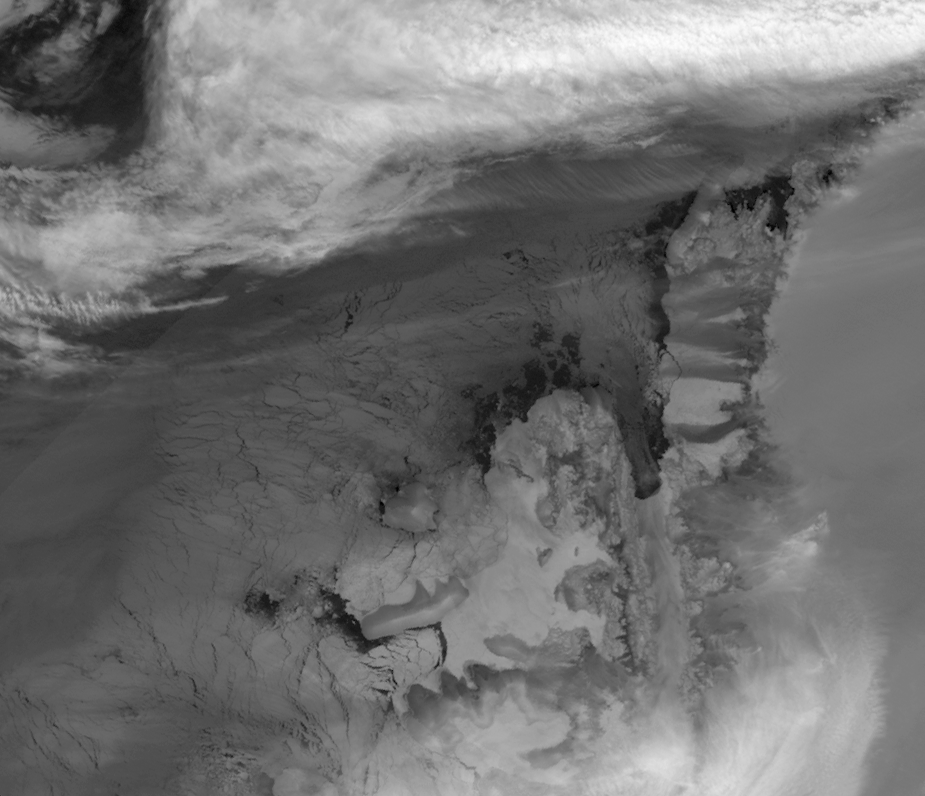
English: This image is made from thermal infra-red data collected by the Moderate Resolution Imaging Spectroradiometer (MODIS) on NASA’s Terra satellite. (A photo-like image isn’t possible at this latitude in the winter because of polar darkness). This greyscale image shows relative differences in surface temperature. Dark grey indicates relatively warm temperatures and white indicates relatively cold temperatures. Remnant ice shelf east of Latady Island appears white, as does some of the sea ice between Charcot and Latady Islands. Charcot Island’s nearly black perimeter indicates an area of relatively open ocean that could be navigated by ship. In addition, an area of relatively warm ocean water appears off the western end of Latady Island. |
| 日期 | |
| 來源 | NASA Earth Observatory |
| 作者 | Jesse Allen |
Data obtained from the Goddard Level 1 and Atmospheric Archive and Distribution System (LAADS). Image interpretation by Ted Scambos, National Snow and Ice Data Centre. Instrument: Terra - MODIS.
授權條款
| 本作品由NASA創作,屬於公有領域。根據NASA的版權政策:“NASA的創作除非另有聲明否則不受版權保護。”(參見:Template:PD-USGov/zh,NASA版權政策或JPL圖像使用政策) | ||
 |
警告:
|
檔案歷史
點選日期/時間以檢視該時間的檔案版本。
| 日期/時間 | 縮圖 | 尺寸 | 使用者 | 備註 | |
|---|---|---|---|---|---|
| 目前 | 2009年8月14日 (五) 09:02 | | 925 × 796(441 KB) | Originalwana | {{Information |Description={{en|1=This image is made from thermal infra-red data collected by the Moderate Resolution Imaging Spectroradiometer (MODIS) on NASA’s Terra satellite. (A photo-like image isn’t possible at this latitude in the winter becaus |
檔案用途
全域檔案使用狀況
以下其他 wiki 使用了這個檔案:
- ceb.wikipedia.org 的使用狀況
- en.wikipedia.org 的使用狀況
- es.wikipedia.org 的使用狀況
- he.wikipedia.org 的使用狀況
- it.wikipedia.org 的使用狀況
- ja.wikipedia.org 的使用狀況
- lld.wikipedia.org 的使用狀況
- nn.wikipedia.org 的使用狀況
- sv.wikipedia.org 的使用狀況
- www.wikidata.org 的使用狀況