
File:CharlestownSC1780.jpg

預覽大小:800 × 548 像素。 其他解析度:320 × 219 像素 | 640 × 438 像素 | 1,024 × 701 像素 | 1,280 × 877 像素 | 1,967 × 1,347 像素。
原始檔案 (1,967 × 1,347 像素,檔案大小:859 KB,MIME 類型:image/jpeg)
摘要
| 描述 |
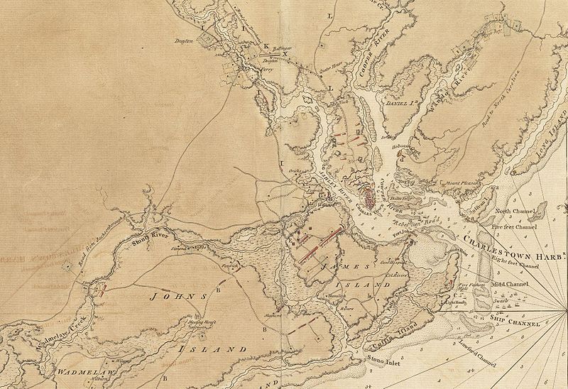
English: This is a detail of the source map, showing the port of Charleston, South Carolina and the coastline to the south as far as Johns Island. It has markings depicting Continental Army defenses set up in anticipation of British attack. The map was probably drawn by British engineers around the time of the 1780 Siege of Charleston. |
||||||
| 日期 | |||||||
| 來源 |
From the Boston Public Library Digital Map Collection: http://maps.bpl.org/details_11098/ |
||||||
| 作者 | George Sproule | ||||||
| 授權許可 (重用此檔案) |
|


檔案歷史
點選日期/時間以檢視該時間的檔案版本。
| 日期/時間 | 縮圖 | 尺寸 | 使用者 | 備註 | |
|---|---|---|---|---|---|
| 目前 | 2009年6月8日 (一) 13:13 | | 1,967 × 1,347(859 KB) | Magicpiano | {{Information |Description={{en|1=This is a detail of the source map, showing the port of Charleston, South Carolina and the coastline to the south as far as Johns Island. It has markings depicting Continental Army defenses set up in anticipation of Brit |
檔案用途
下列頁面有用到此檔案:
全域檔案使用狀況
以下其他 wiki 使用了這個檔案:
- ca.wikipedia.org 的使用狀況
- en.wikipedia.org 的使用狀況
- es.wikipedia.org 的使用狀況
- fr.wikipedia.org 的使用狀況
- he.wikipedia.org 的使用狀況
- ru.wikipedia.org 的使用狀況