
File:Cook-1777.jpg
預覽大小:800 × 560 像素。 其他解析度:320 × 224 像素 | 640 × 448 像素 | 1,024 × 717 像素 | 1,269 × 888 像素。
原始檔案 (1,269 × 888 像素,檔案大小:539 KB,MIME 類型:image/jpeg)
摘要
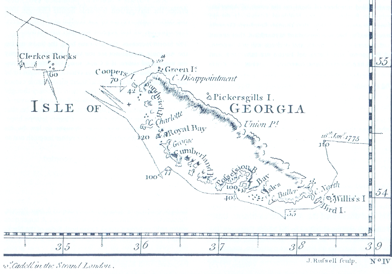
James Cook, Chart of the Discoveries made in the South Atlantic Ocean, in His Majestys Ship Resolution, under the Command of Captain Cook, in January 1775, W. Strahan and T. Cadel, London, 1777 (fragment)

|
這個檔案已經被Cook-1777.PNG取代。 建議您使用其他圖像。請注意要刪除被取代的圖像的話,您需要首先取得社群共識。
|

|
授權條款
|
本作品在其來源國以及其他著作權期限是作者逝世後70年或以下的國家與地區屬於公有領域。 | |
| 此作品無已知的著作權限制,亦不受所有相關和鄰接的權利限制。 | |
檔案歷史
點選日期/時間以檢視該時間的檔案版本。
| 日期/時間 | 縮圖 | 尺寸 | 使用者 | 備註 | |
|---|---|---|---|---|---|
| 目前 | 2006年5月6日 (六) 19:21 | | 1,269 × 888(539 KB) | Apcbg | James Cook, Chart of the Discoveries made in the South Atlantic Ocean, in His Majestys Ship Resolution, under the Command of Captain Cook, in January 1775, W. Strahan and T. Cadel, London, 1777 (fragment) |
檔案用途
全域檔案使用狀況
以下其他 wiki 使用了這個檔案:
- ang.wikipedia.org 的使用狀況
- ar.wikipedia.org 的使用狀況
- ast.wikipedia.org 的使用狀況
- az.wikipedia.org 的使用狀況
- bg.wikipedia.org 的使用狀況
- bn.wikipedia.org 的使用狀況
- ca.wikipedia.org 的使用狀況
- ceb.wikipedia.org 的使用狀況
- cs.wikipedia.org 的使用狀況
- cv.wikipedia.org 的使用狀況
- de.wikipedia.org 的使用狀況
- en.wikipedia.org 的使用狀況
- en.wikivoyage.org 的使用狀況
- eo.wikipedia.org 的使用狀況
- es.wikipedia.org 的使用狀況
- eu.wikipedia.org 的使用狀況
- fr.wikipedia.org 的使用狀況
- gl.wikipedia.org 的使用狀況
- hu.wikipedia.org 的使用狀況
- hy.wikipedia.org 的使用狀況
- it.wikipedia.org 的使用狀況
檢視此檔案的更多全域使用狀況。