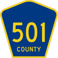
File:County 501.svg

此 SVG 檔案的 PNG 預覽的大小:451 × 451 像素。 其他解析度:240 × 240 像素 | 480 × 480 像素 | 768 × 768 像素 | 1,024 × 1,024 像素 | 2,048 × 2,048 像素。
原始檔案 (SVG 檔案,表面大小:451 × 451 像素,檔案大小:9 KB)
檔案歷史
點選日期/時間以檢視該時間的檔案版本。
| 日期/時間 | 縮圖 | 尺寸 | 使用者 | 備註 | |
|---|---|---|---|---|---|
| 目前 | 2012年3月23日 (五) 00:28 |  | 451 × 451(9 KB) | TwinsMetsFan | |
| 2006年7月17日 (一) 13:22 |  | 450 × 450(13 KB) | Northenglish | {{PD-self}} |
檔案用途
下列頁面有用到此檔案:
全域檔案使用狀況
以下其他 wiki 使用了這個檔案:
- en.wikipedia.org 的使用狀況
- Goethals Bridge
- Outerbridge Crossing
- Bayonne Bridge
- Newark Bay Bridge
- County Route 501 (New Jersey)
- List of highways numbered 501
- Talk:Communipaw
- Wikipedia:Featured list candidates/Failed log/December 2009
- Talk:Boulevard East
- Wikipedia:Featured list candidates/List of numbered roads in Kawartha Lakes, Ontario/archive2
- User:DanTD/Sandbox/List of county routes in Hudson County, New Jersey (600-650)
- User:Morriswa/Clinched highways/State highways
- User:Morriswa/Clinched highways/County and other highways
- es.wikipedia.org 的使用狀況


