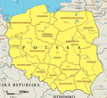
File:EC map of poland.png
外觀
EC_map_of_poland.png (600 × 548 像素,檔案大小:59 KB,MIME 類型:image/png)
檔案歷史
點選日期/時間以檢視該時間的檔案版本。
| 日期/時間 | 縮圖 | 尺寸 | 使用者 | 備註 | |
|---|---|---|---|---|---|
| 目前 | 2005年2月26日 (六) 18:08 |  | 600 × 548(59 KB) | Micga~commonswiki |
檔案用途
下列40個頁面有用到此檔案:
全域檔案使用狀況
以下其他 wiki 使用了這個檔案:
- ace.wikipedia.org 的使用狀況
- br.wikipedia.org 的使用狀況
- bs.wikipedia.org 的使用狀況
- btm.wikipedia.org 的使用狀況
- de.wikipedia.org 的使用狀況
- fi.wikipedia.org 的使用狀況
- fy.wikipedia.org 的使用狀況
- id.wikipedia.org 的使用狀況
- incubator.wikimedia.org 的使用狀況
- it.wikipedia.org 的使用狀況
- ja.wikipedia.org 的使用狀況
- jv.wikipedia.org 的使用狀況
- nl.wikipedia.org 的使用狀況
- ru.wikipedia.org 的使用狀況
- su.wikipedia.org 的使用狀況
- zea.wikipedia.org 的使用狀況
- zh-classical.wikipedia.org 的使用狀況


