
File:Europe 526-600.jpg

預覽大小:381 × 599 像素。 其他解析度:152 × 240 像素 | 305 × 480 像素 | 907 × 1,427 像素。
原始檔案 (907 × 1,427 像素,檔案大小:410 KB,MIME 類型:image/jpeg)
摘要
| 描述 |
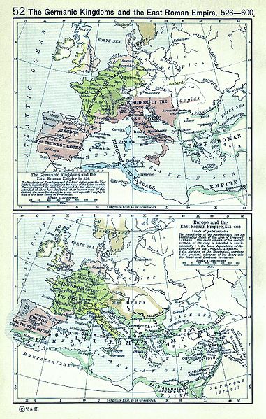
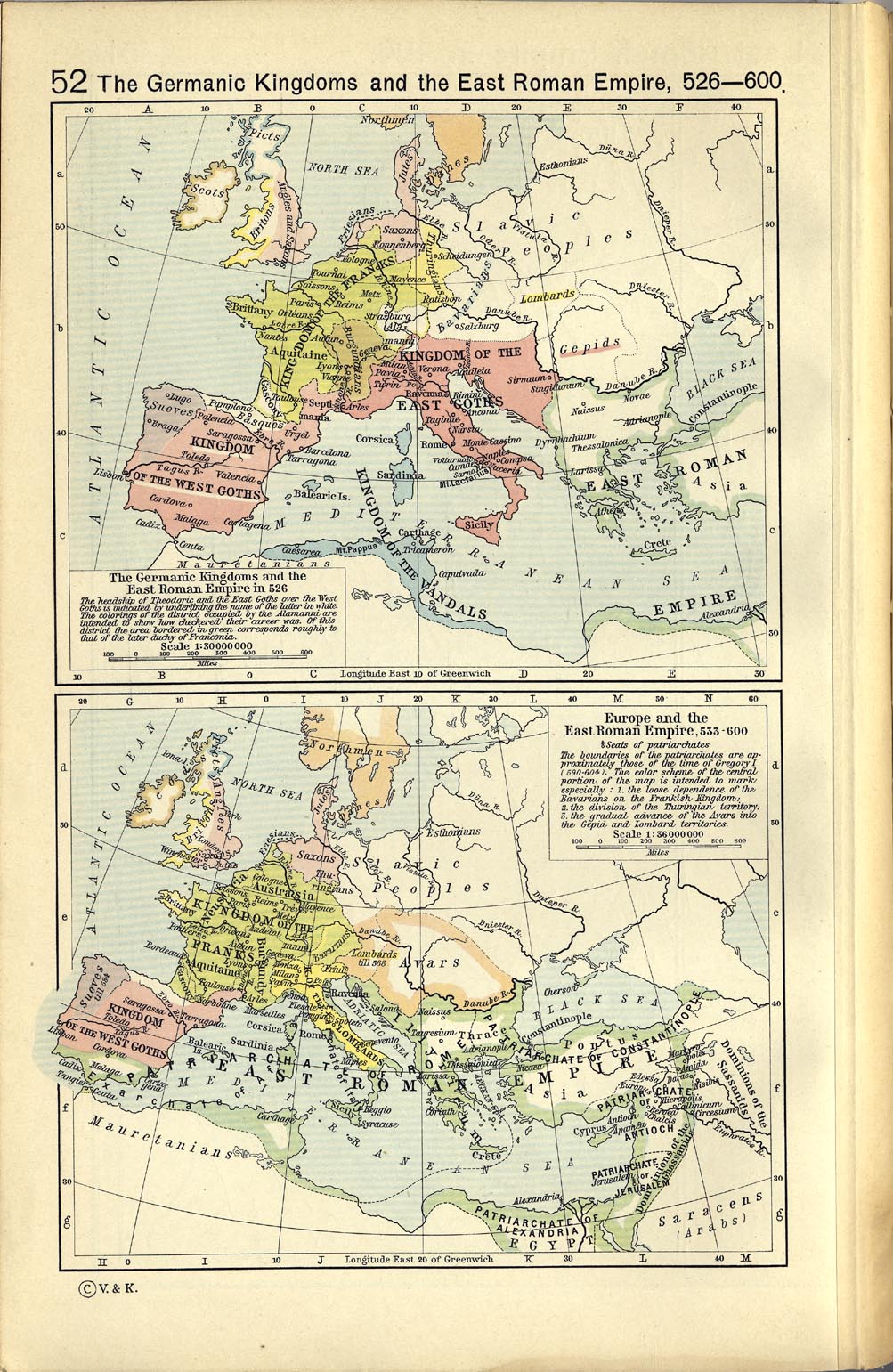
English: A map political map of Europe, situation as of c. 526-600 |
| 日期 | |
| 來源 | Shepherd, William R. (1923年) 《 Historical Atlas》、Category:New York: Henry Holt and Company |
| 作者 | |
| 其他版本 |
|
.jpg)

授權條款
|
本作品作者於1934年逝世,在其來源國以及其他著作權期限是作者逝世後80年或以下的國家與地區屬於公有領域。 | |
| 此作品無已知的著作權限制,亦不受所有相關和鄰接的權利限制。 | |
_en.png)
.png)
.jpg)
檔案歷史
點選日期/時間以檢視該時間的檔案版本。
| 日期/時間 | 縮圖 | 尺寸 | 使用者 | 備註 | |
|---|---|---|---|---|---|
| 目前 | 2008年3月13日 (四) 13:22 | | 907 × 1,427(410 KB) | F l a n k e r | Cleaning (hope you likes) |
| 2006年5月8日 (一) 10:28 |  | 1,003 × 1,541(391 KB) | Roke~commonswiki | Europe 526-600AD {{Europe}} {{PD-PCL|http://www.lib.utexas.edu/maps/historical/shepherd_1911/shepherd-c-052.jpg}} Category: Historical maps of Europe |
檔案用途
下列頁面有用到此檔案:
全域檔案使用狀況
以下其他 wiki 使用了這個檔案:
- ba.wikipedia.org 的使用狀況
- bg.wikipedia.org 的使用狀況
- en.wikipedia.org 的使用狀況
- et.wikipedia.org 的使用狀況
- fr.wikipedia.org 的使用狀況
- it.wikipedia.org 的使用狀況
- mwl.wikipedia.org 的使用狀況
- pt.wikipedia.org 的使用狀況
- ru.wikipedia.org 的使用狀況
- scn.wikipedia.org 的使用狀況
- vi.wikipedia.org 的使用狀況