跳至內容

File:France map Lambert-93 with regions and departments polygons-blank.svg

頁面內容不支援其他語言。
這個檔案來自維基共享資源
維基百科,自由的百科全書

原始檔案(SVG 檔案,表面大小:2,000 × 1,898 像素,檔案大小:1.57 MB)


摘要

拍攝地點46° 15′ 00″ 北, 2° 06′ 00″ 東 Kartographer map based on OpenStreetMap.位於此地的本圖片與其他圖片: OpenStreetMapinfo
描述
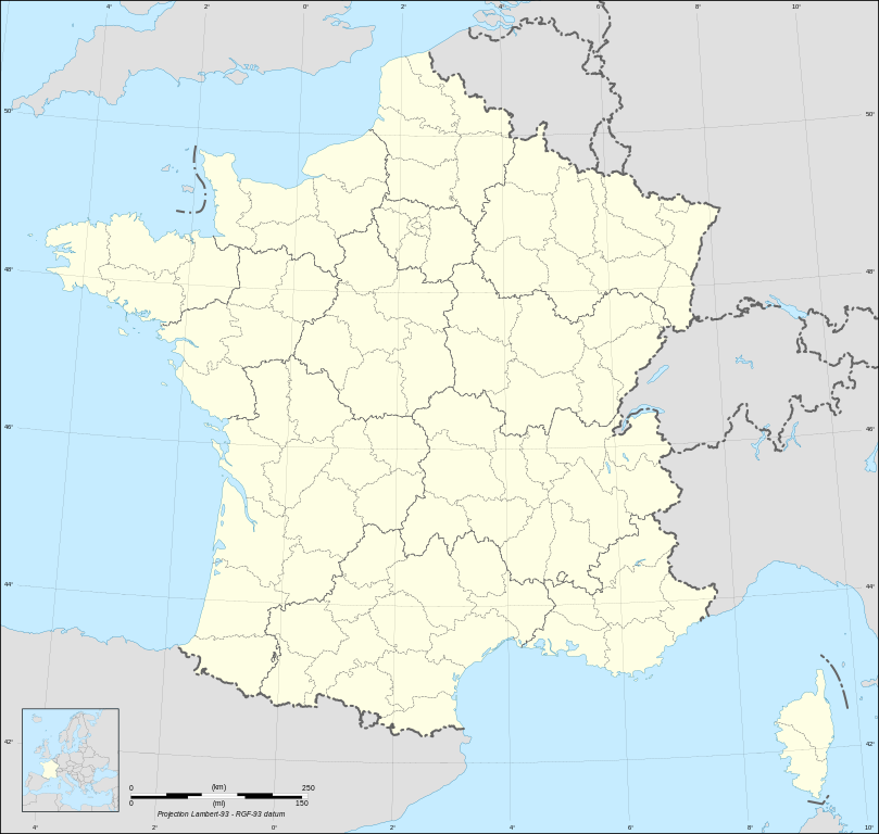
English: Blank map of metropolitan France in the official Lambert-93 projection, with regions and departments as independent polygons.

Instructions of use:

  • Each region and department is an independent object composed by one or more closed polygons which can be colored separately;
  • Each region and department can be found in its proper layer well identified;
  • The regions and the departments which compose them are redundant: delete the administrative divisions you don't need to allow a lighter file size;
  • The departments boundaries which are also boundaries between regions are redundant too: if you need only the departments boundaries, delete the layer < Regions boundaries >; if you want to discriminate the departments and regions boundaries, delete this path in the layer < Departments boundaries >, this again to allow a lighter file size;
  • At this time, France's surrounding countries aren't separated one from the other.

Français : Carte vierge de la France métropolitaine suivant la projection officielle Lambert-93, avec régions et départements en tant que polygones indépendants.

Instructions d'utilisation :

  • Chaque région et département est un objet indépendant composé d'un ou plusieurs polygones fermés qui peut être mis en couleur séparément ;
  • Chaque région et département est classé dans son propre calque clairement identifié ;
  • Les régions et les départements qui les composent sont redondants : supprimez le niveau administratif dont vous n'avez pas besoin afin d'alléger le poids du fichier ;
  • Les limites de départements qui correspondent aussi à des limites de régions sont également redondantes : si vous ne voulez que les limites de départements, supprimez le calque < Regions boundaries > ; si vous voulez faire la distinction entre les limites de départements et de régions, supprimez le chemin correspondant dans le calque < Departments boundaries >, ceci à nouveau afin de diminuer le poids du fichier ;
  • À l'heure actuelle les pays voisins de la France forment un seul bloc.

Lambert-93 projection ; RGF-93 datum

Scale: 1:2,000,000
日期
來源

Own work, derivate from France map Lambert-93 with regions and departments-blank.svg created by myself

  • Source of data: NGDC World Data Bank II (public domain)
作者 Eric Gaba (Sting - fr:Sting)
授權許可
(重用此檔案)
Attribution and Share-Alike required
其他版本

Derivative works of this file:

[編輯]

Same map but with topography and bathymetry:

SVG開發
InfoField
 
SVG檔案的原始碼通過W3C驗證
 
vector image使用Inkscape創作,或使用了其他工具。
 
 這個SVG 檔案使用了內置文字,可以使用任何文字編輯器輕鬆翻譯

授權條款

我,本作品的著作權持有者,決定用以下授權條款發佈本作品:
GNU head 已授權您依據自由軟體基金會發行的無固定段落、封面文字和封底文字GNU自由文件授權條款1.2版或任意後續版本,對本檔進行複製、傳播和/或修改。該協議的副本列在GNU自由文件授權條款中。
w:zh:創用CC
姓名標示 相同方式分享
本文件采用知识共享署名-相同方式共享4.0 国际3.0 未本地化版本2.5 通用2.0 通用1.0 通用许可协议授权。
您可以自由:
  • 分享 – 複製、發佈和傳播本作品
  • 重新修改 – 創作演繹作品
惟需遵照下列條件:
  • 姓名標示 – 您必須指名出正確的製作者,和提供授權條款的連結,以及表示是否有對內容上做出變更。您可以用任何合理的方式來行動,但不得以任何方式表明授權條款是對您許可或是由您所使用。
  • 相同方式分享 – 如果您利用本素材進行再混合、轉換或創作,您必須基於如同原先的相同或兼容的條款,來分布您的貢獻成品。
您可以選擇您需要的授權條款。

說明

添加單行說明來描述出檔案所代表的內容

在此檔案描寫的項目

描繪內容

視角坐標 繁體中文 (已轉換拼寫)

46°15'0.000"N, 2°6'0.000"E

檔案歷史

點選日期/時間以檢視該時間的檔案版本。

日期/時間縮⁠圖尺寸使用者備⁠註
目前2024年5月7日 (二) 11:39於 2024年5月7日 (二) 11:39 版本的縮圖2,000 × 1,898(1.57 MB)Jack maUpdated regions limits of 2016
2017年10月19日 (四) 15:18於 2017年10月19日 (四) 15:18 版本的縮圖2,000 × 1,898(1.78 MB)StingNo borders over the Lake of Constance
2009年2月3日 (二) 18:58於 2009年2月3日 (二) 18:58 版本的縮圖2,000 × 1,898(1.79 MB)Sting== Summary == {{Location|46|15|00|N|02|06|00|E|scale:5000000}} <br/> {{Information |Description={{en|Blank map of France in the official Lambert-93 projection, with regions and departments as independent polygons.<br/> '''''Instructions of

沒有使用此檔案的頁面。

全域檔案使用狀況

詮釋資料