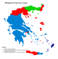
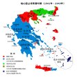
File:Gr-triple-occupation.png
外觀

預覽大小:588 × 600 像素。 其他解析度:235 × 240 像素 | 471 × 480 像素 | 899 × 917 像素。
原始檔案 (899 × 917 像素,檔案大小:82 KB,MIME 類型:image/png)
檔案歷史
點選日期/時間以檢視該時間的檔案版本。
| 日期/時間 | 縮圖 | 尺寸 | 使用者 | 備註 | |
|---|---|---|---|---|---|
| 目前 | 2006年5月22日 (一) 15:48 |  | 899 × 917(82 KB) | GhePeU | slightly reworked image |
| 2005年7月2日 (六) 16:06 |  | 899 × 917(107 KB) | Michalis Famelis | Map showning the zones of control of the three occupying powers in Greece during WW2, from 1941 to 1944. The image was created by me using another map as a template. This image was created using the Gimp. {{GFDL}} |
檔案用途
全域檔案使用狀況
以下其他 wiki 使用了這個檔案:
- ca.wikipedia.org 的使用狀況
- de.wikipedia.org 的使用狀況
- en.wikipedia.org 的使用狀況
- hu.wikipedia.org 的使用狀況
- ku.wikipedia.org 的使用狀況
- lv.wikipedia.org 的使用狀況
- ro.wikipedia.org 的使用狀況
- sv.wikipedia.org 的使用狀況
- tr.wikipedia.org 的使用狀況


