
File:Lasithi municipalities numbered.png

預覽大小:800 × 586 像素。 其他解析度:320 × 235 像素 | 640 × 469 像素 | 1,000 × 733 像素。
原始檔案 (1,000 × 733 像素,檔案大小:72 KB,MIME 類型:image/png)
摘要
| 描述 |
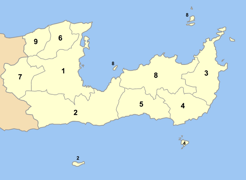
Map of Lasithi prefecture (Greece) with administrative divisions (municipalities and communities) numbered in alphabetical order (in greek). Legend:
|
| 日期 | |
| 來源 | 自己的作品 |
| 作者 | Pitichinaccio |
授權條款
| 我,此作品的版權所有人,釋出此作品至公共領域。此授權條款在全世界均適用。 這可能在某些國家不合法,如果是的話: 我授予任何人有權利使用此作品於任何用途,除受法律約束外,不受任何限制。 |
檔案歷史
點選日期/時間以檢視該時間的檔案版本。
| 日期/時間 | 縮圖 | 尺寸 | 使用者 | 備註 | |
|---|---|---|---|---|---|
| 目前 | 2007年9月2日 (日) 15:48 | | 1,000 × 733(72 KB) | Pitichinaccio | {{Information |Description=Map of Lasithi prefecture (Greece) with administrative divisions (municipalities and communities) numbered in alphabetical order (in greek). Legend: * 1. Δήμος Αγίου Νικολάου - Agios Nikolaos * 2. Δήμος � |
檔案用途
沒有使用此檔案的頁面。
全域檔案使用狀況
以下其他 wiki 使用了這個檔案:
- de.wikipedia.org 的使用狀況
- el.wikipedia.org 的使用狀況
- fi.wikipedia.org 的使用狀況
- hr.wikipedia.org 的使用狀況
- it.wikipedia.org 的使用狀況
- ja.wikipedia.org 的使用狀況
- ko.wikipedia.org 的使用狀況
- la.wikipedia.org 的使用狀況
- ru.wikipedia.org 的使用狀況