
File:Map of Serbia (municipalities).PNG
預覽大小:426 × 599 像素。 其他解析度:171 × 240 像素 | 341 × 480 像素 | 976 × 1,372 像素。
原始檔案 (976 × 1,372 像素,檔案大小:946 KB,MIME 類型:image/png)
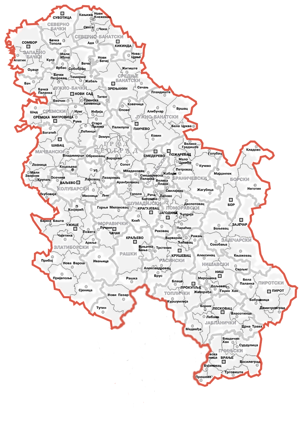
| 描述 | This map shows Serbian municipalities after Kosovo declared independence in 2008 | ||
| 日期 | |||
| 來源 | Administrative map of Serbia on the Serbian Wikipedia | ||
| 作者 | Bože pravde added the towns, villages and names of municipalities | ||
| 授權許可 (重用此檔案) |
|
||
| 其他版本 |
|
.png)
.PNG?uselang=zh-tw)
.PNG?uselang=zh-tw)
.PNG?action=history&uselang=zh-tw)
.PNG)
檔案歷史
點選日期/時間以檢視該時間的檔案版本。
.PNG&variant=zh-tw&dir=prev)
.PNG&variant=zh-tw&offset=20131016071409)
.PNG&variant=zh-tw&offset=&limit=20)
.PNG&variant=zh-tw&offset=&limit=50)
.PNG&variant=zh-tw&offset=&limit=100)
.PNG&variant=zh-tw&offset=&limit=250)
.PNG&variant=zh-tw&offset=&limit=500)
| 日期/時間 | 縮圖 | 尺寸 | 使用者 | 備註 | |
|---|---|---|---|---|---|
| 目前 | 2020年1月26日 (日) 09:29 | | 976 × 1,372(946 KB) | Denniss | Reverted to version as of 11:53, 15 January 2014 (UTC) - nationalist POV |
| 2020年1月26日 (日) 08:11 |  | 976 × 1,372(1.04 MB) | Sadko | Reverted to version as of 10:55, 15 January 2014 (UTC) per NPOV and the fact that this is a disputed aread and NOT a UN member state. Views of editor's country of origin are not relevant in this matter, and we should go per NPOV. | |
| 2014年1月15日 (三) 11:53 |  | 976 × 1,372(946 KB) | Denniss | Reverted to version as of 13:17, 3 December 2013 | |
| 2014年1月15日 (三) 10:55 |  | 976 × 1,372(1.04 MB) | Milicevic01 | Reverted to version as of 12:12, 3 December 2013 | |
| 2013年12月3日 (二) 13:17 |  | 976 × 1,372(946 KB) | Denniss | Reverted to version as of 15:38, 2 December 2013 | |
| 2013年12月3日 (二) 12:12 |  | 976 × 1,372(1.04 MB) | Nikola Smolenski | Reverted to version as of 15:06, 2 December 2013 | |
| 2013年12月2日 (一) 15:38 |  | 976 × 1,372(946 KB) | Bobrayner | Back to the consensus version. Welcome to 2013! | |
| 2013年12月2日 (一) 15:06 |  | 976 × 1,372(1.04 MB) | Nikola Smolenski | Reverted to version as of 00:28, 16 October 2013: By laws of Serbia, these are still municipalities of Serbia | |
| 2013年11月30日 (六) 08:20 |  | 976 × 1,372(946 KB) | Denniss | Reverted to version as of 07:14, 16 October 2013 | |
| 2013年10月16日 (三) 07:14 |  | 976 × 1,372(946 KB) | No More Cats | updating to reflect 2008 borders, per File talk:Continental-Europe-map.png |
檔案用途
沒有使用此檔案的頁面。
.PNG)