
File:Map of the Dutch Cape Colony in 1795.jpg
預覽大小:800 × 475 像素。 其他解析度:320 × 190 像素 | 640 × 380 像素 | 1,024 × 608 像素 | 1,280 × 761 像素 | 2,560 × 1,521 像素 | 3,546 × 2,107 像素。
原始檔案 (3,546 × 2,107 像素,檔案大小:763 KB,MIME 類型:image/jpeg)
摘要
| 描述 |
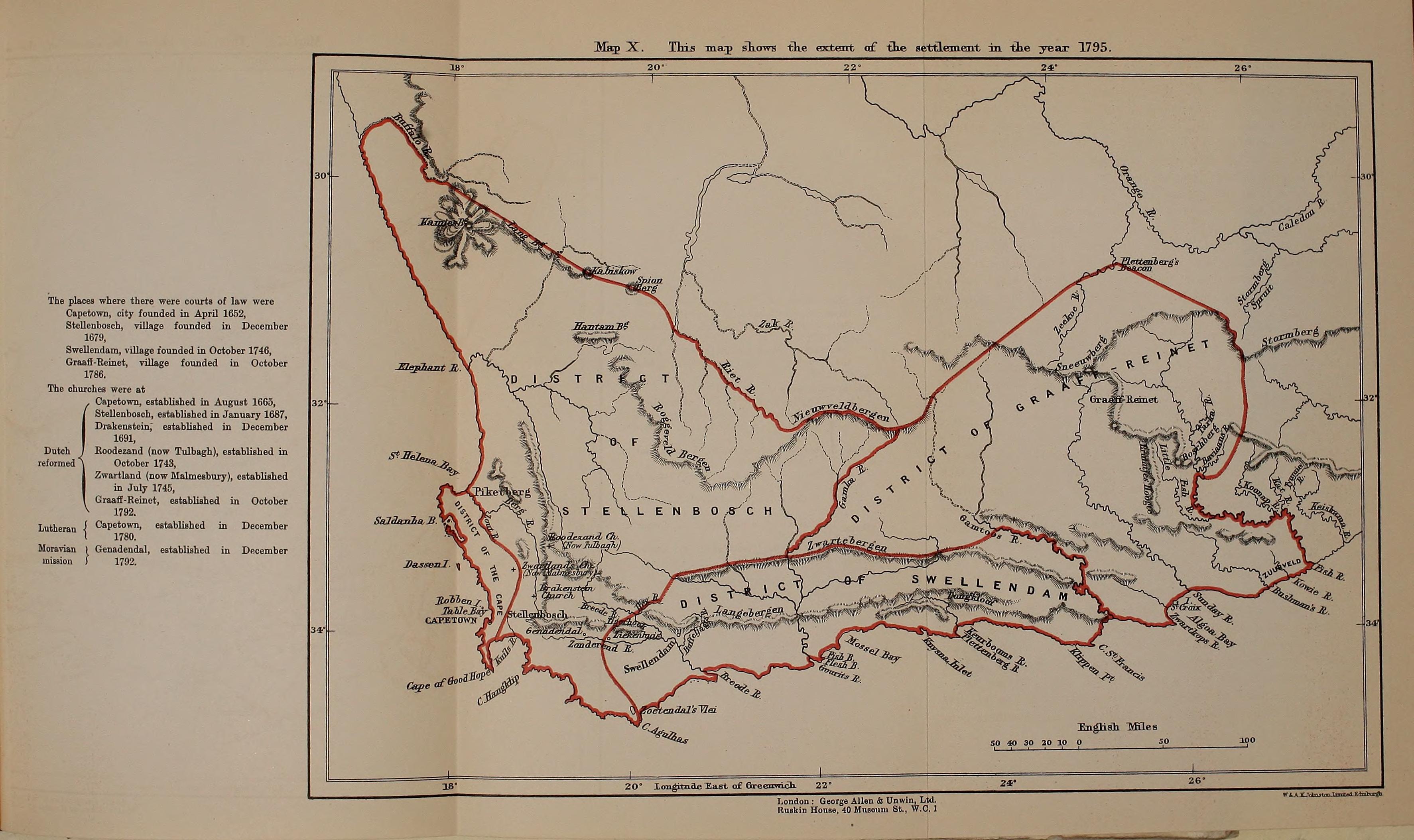
English: Map of the Dutch Cape Colony in 1795, from page 374 of "History of Africa south of the Zambesi - from the settlement of the Portuguese at Sofala in September 1505 to the conquest of the Cape Colony by the British in September 1795" (1916) |
|||||||||||||||||
| 日期 | ||||||||||||||||||
| 來源 | https://archive.org/stream/historyofafricas03thea/historyofafricas03thea#page/n374/mode/1up | |||||||||||||||||
| 作者 |
|
|||||||||||||||||

授權條款
|
本作品在其來源國以及其他著作權期限是作者逝世後70年或以下的國家與地區屬於公有領域。 | |
| 此作品無已知的著作權限制,亦不受所有相關和鄰接的權利限制。 | |
檔案歷史
點選日期/時間以檢視該時間的檔案版本。
| 日期/時間 | 縮圖 | 尺寸 | 使用者 | 備註 | |
|---|---|---|---|---|---|
| 目前 | 2014年8月28日 (四) 21:21 | | 3,546 × 2,107(763 KB) | Underlying lk | User created page with UploadWizard |
檔案用途
下列頁面有用到此檔案:
全域檔案使用狀況
以下其他 wiki 使用了這個檔案:
- en.wikipedia.org 的使用狀況
- es.wikipedia.org 的使用狀況
- it.wikipedia.org 的使用狀況
- ru.wikipedia.org 的使用狀況
- simple.wikipedia.org 的使用狀況
- uk.wikipedia.org 的使用狀況