
File:Middle Creek Battlefield.jpg

預覽大小:800 × 532 像素。 其他解析度:320 × 213 像素 | 640 × 426 像素 | 1,024 × 681 像素 | 1,280 × 851 像素 | 2,560 × 1,702 像素 | 6,016 × 4,000 像素。
原始檔案 (6,016 × 4,000 像素,檔案大小:6.22 MB,MIME 類型:image/jpeg)
| 拍攝地點 | | 位於此地的本圖片與其他圖片: OpenStreetMap |
|---|
| 描述 |
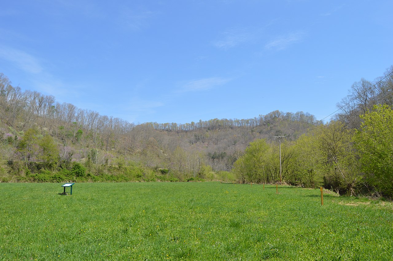
English: Looking northeast in the eastern section of the Middle Creek Battlefield, located west of Prestonsburg in Floyd County, Kentucky, United States. The hill in the distance was Union Colonel James Garfield's command post, while the Confederate position was on the hillside and hilltop barely visible to the far right. Fought here in early 1862, Middle Creek was one of the most decisive battles of the Civil War in eastern Kentucky. The site has been designated a National Historic Landmark. |
||
| 日期 | 攝於2014年4月21日 | ||
| 來源 | 自己的作品 | ||
| 作者 | Nyttend | ||
| 授權許可 (重用此檔案) |
|
檔案歷史
點選日期/時間以檢視該時間的檔案版本。
| 日期/時間 | 縮圖 | 尺寸 | 使用者 | 備註 | |
|---|---|---|---|---|---|
| 目前 | 2014年5月4日 (日) 21:19 | | 6,016 × 4,000(6.22 MB) | Nyttend | {{NRHP|91001665}} {{Location|37|39|4|N|82|48|44|W}} {{Information |Description={{en|Looking northeast in the eastern section of the {{w|Battle of Middle Creek|Middle Creek Battlefield}}, located west of {{w|Prestonsburg, Kentucky|Prestonsburg}} in {{w|... |
檔案用途
下列頁面有用到此檔案:
全域檔案使用狀況
以下其他 wiki 使用了這個檔案:
- de.wikipedia.org 的使用狀況
- en.wikipedia.org 的使用狀況
- en.wikivoyage.org 的使用狀況
- he.wikipedia.org 的使用狀況
- nl.wikipedia.org 的使用狀況
- www.wikidata.org 的使用狀況