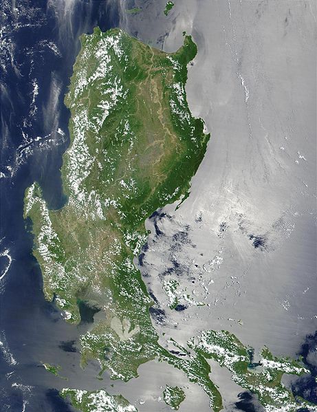
File:Northern Philippines (Luzon).jpg

預覽大小:461 × 599 像素。 其他解析度:184 × 240 像素 | 369 × 480 像素 | 591 × 768 像素 | 788 × 1,024 像素 | 2,000 × 2,600 像素。
原始檔案 (2,000 × 2,600 像素,檔案大小:738 KB,MIME 類型:image/jpeg)
檔案歷史
點選日期/時間以檢視該時間的檔案版本。
| 日期/時間 | 縮圖 | 尺寸 | 使用者 | 備註 | |
|---|---|---|---|---|---|
| 目前 | 2005年10月25日 (二) 21:52 |  | 2,000 × 2,600(738 KB) | Brian0918 | * Credit Jacques Descloitres, MODIS Land Rapid Response Team, NASA/GSFC This MODIS true-color image of the northern Philippines shows the island of Luzon and the Cagayan River running in the plains between the Sierra Madre mountain rang |
檔案用途
下列頁面有用到此檔案:
全域檔案使用狀況
以下其他 wiki 使用了這個檔案:
- af.wikipedia.org 的使用狀況
- ar.wikipedia.org 的使用狀況
- arz.wikipedia.org 的使用狀況
- ast.wikipedia.org 的使用狀況
- ba.wikipedia.org 的使用狀況
- be-tarask.wikipedia.org 的使用狀況
- be.wikipedia.org 的使用狀況
- bg.wikipedia.org 的使用狀況
- bjn.wikipedia.org 的使用狀況
- bo.wikipedia.org 的使用狀況
- ca.wikipedia.org 的使用狀況
- cy.wikipedia.org 的使用狀況
- de.wikipedia.org 的使用狀況
- el.wikipedia.org 的使用狀況
- en.wikipedia.org 的使用狀況
- eo.wikipedia.org 的使用狀況
- es.wikipedia.org 的使用狀況
- et.wikipedia.org 的使用狀況
- eu.wikipedia.org 的使用狀況
- fa.wikipedia.org 的使用狀況
- fi.wiktionary.org 的使用狀況
- fr.wikipedia.org 的使用狀況
- fr.wikivoyage.org 的使用狀況
- ga.wikipedia.org 的使用狀況
- he.wikipedia.org 的使用狀況
- hu.wikipedia.org 的使用狀況
- hy.wikipedia.org 的使用狀況
- ia.wikipedia.org 的使用狀況
- id.wikipedia.org 的使用狀況
- id.wiktionary.org 的使用狀況
- incubator.wikimedia.org 的使用狀況
- jv.wikipedia.org 的使用狀況
- ka.wikipedia.org 的使用狀況
- ky.wikipedia.org 的使用狀況
- lv.wikipedia.org 的使用狀況
- ms.wikipedia.org 的使用狀況
- nn.wikipedia.org 的使用狀況
- os.wikipedia.org 的使用狀況
- pl.wikipedia.org 的使用狀況
檢視此檔案的更多全域使用狀況。


