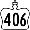
File:Ontario 406 crown.svg
外觀

此 SVG 檔案的 PNG 預覽的大小:600 × 600 像素。 其他解析度:240 × 240 像素 | 480 × 480 像素 | 768 × 768 像素 | 1,024 × 1,024 像素 | 2,048 × 2,048 像素 | 601 × 601 像素。
原始檔案 (SVG 檔案,表面大小:601 × 601 像素,檔案大小:21 KB)
檔案歷史
點選日期/時間以檢視該時間的檔案版本。
| 日期/時間 | 縮圖 | 尺寸 | 使用者 | 備註 | |
|---|---|---|---|---|---|
| 目前 | 2019年4月19日 (五) 01:43 |  | 601 × 601(21 KB) | Fredddie | redrawn |
| 2010年1月31日 (日) 23:35 |  | 289 × 289(8 KB) | Floydian | {{Information |Description=This is a rough approximation of the junction marker used on King's Highways in Ontario. |Source=modified from Image:Ontario Junction template.svg |Date= |Author=NE2 |Permission= |other_versions= }} {{PD-inelig |
檔案用途
下列頁面有用到此檔案:
全域檔案使用狀況
以下其他 wiki 使用了這個檔案:
- en.wikipedia.org 的使用狀況
- St. Catharines
- Welland
- Queen Elizabeth Way
- Ontario Highway 58
- Lakeshore West line
- Mid-Peninsula Highway
- Ontario Highway 20
- Ontario Highway 8
- List of Ontario provincial highways
- User:Floydian/RTL
- Template:Infobox road/testcases/CAN
- User:Floydian/Queen Elizabeth Way
- Template:GO Transit Lakeshore West
- User:Floydian/Daily check
- User:Useddenim/GO Transit rail system
- List of controlled-access highways in Ontario
- simple.wikipedia.org 的使用狀況

