
File:Puertogalera chart 4344 1917.jpeg
預覽大小:677 × 600 像素。 其他解析度:271 × 240 像素 | 542 × 480 像素 | 867 × 768 像素 | 1,156 × 1,024 像素 | 2,311 × 2,048 像素 | 3,626 × 3,213 像素。
原始檔案 (3,626 × 3,213 像素,檔案大小:1.69 MB,MIME 類型:image/jpeg)
摘要
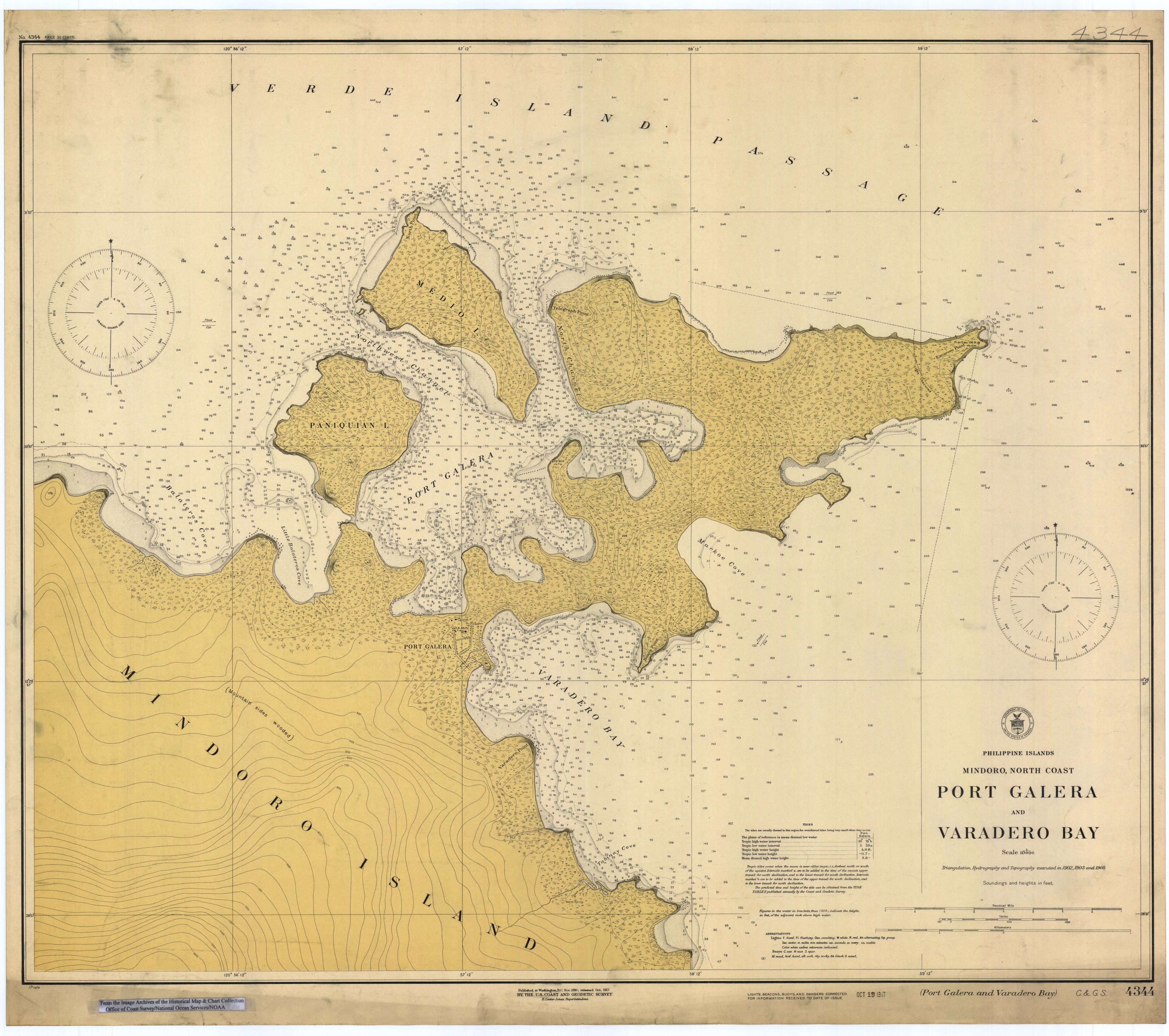
- Map of Port Galera (Puerto Galera) and Varadero Bay, Mindoro island, Philippines, 1917.
- Scanned image of US Coast & Geodetic Survey (Manila Office) nautical chart #4344.
- Credits
From the Image Archives of the Historical Map & Chart Collection archive copy at the Wayback Machine/Office of Coast Survey/National Ocean Service/NOAA/United States government. Converted from MrSID to JPEG format for upload to Commons.
授權條款
本圖像屬於公有領域,因該作品最初來自於美國國家海洋和大氣管理局職員的職務作品。
|
檔案歷史
點選日期/時間以檢視該時間的檔案版本。
| 日期/時間 | 縮圖 | 尺寸 | 使用者 | 備註 | |
|---|---|---|---|---|---|
| 目前 | 2006年3月17日 (五) 01:51 | | 3,626 × 3,213(1.69 MB) | Cdc~commonswiki | Scanned image of US Coast & Geodetic Survey (Manila Office) nautical chart #4344 Port Galera (Puerto Galera) and Varadero Bay, Mindoro, Philippines, 1917. From the Image Archives of the [http://chartmaker.ncd.noaa.gov/csdl/ctp/abstract.htm Historical Ma |
檔案用途
下列頁面有用到此檔案:
全域檔案使用狀況
以下其他 wiki 使用了這個檔案:
- en.wikipedia.org 的使用狀況
- id.wikipedia.org 的使用狀況
- pam.wikipedia.org 的使用狀況
- sv.wikipedia.org 的使用狀況