
File:Rottnest Island.jpg
預覽大小:800 × 399 像素。 其他解析度:320 × 159 像素 | 857 × 427 像素。
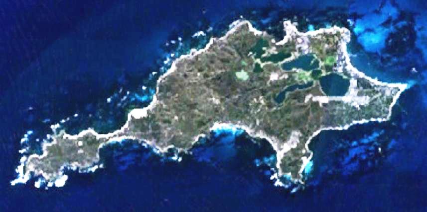
原始檔案 (857 × 427 像素,檔案大小:47 KB,MIME 類型:image/jpeg)
| 描述 | This is a map of the Rottnest Island, Western Australia. | |||
| 來源 | It was made by the uploader using NASA World Wind using Landsat 7 data. | |||
| 作者 | Created by the uploader. Any IP involved in the creation of this image is released into the public domain. | |||
| 授權許可 (重用此檔案) |
|

檔案歷史
點選日期/時間以檢視該時間的檔案版本。
| 日期/時間 | 縮圖 | 尺寸 | 使用者 | 備註 | |
|---|---|---|---|---|---|
| 目前 | 2008年6月23日 (一) 23:28 | | 857 × 427(47 KB) | Hesperian | Reverted to version as of 01:37, 1 May 2007 |
| 2007年5月1日 (二) 01:37 |  | 857 × 427(47 KB) | Moondyne | {{Information |Description=This is a map of the Rottnest Island, Western Australia, made with World Wind using Landsat 7 data. (Adjusted for contrast) |Source= |Date= |Author=Created by the uploader. Any IP involved in the creation of this image is relea | |
| 2006年11月16日 (四) 03:16 |  | 857 × 427(38 KB) | Hesperian | {{Information |Description=This is a map of the Rottnest Island, Western Australia, made with World Wind using Landsat 7 data. |Source= |Date= |Author=Created by the uploader. Any IP involved in the creation of this image is released into the public domai |
檔案用途
下列頁面有用到此檔案:
全域檔案使用狀況
以下其他 wiki 使用了這個檔案:
- cs.wikipedia.org 的使用狀況
- en.wikipedia.org 的使用狀況
- fa.wikipedia.org 的使用狀況
- fi.wikipedia.org 的使用狀況
- fr.wikipedia.org 的使用狀況
- gl.wikipedia.org 的使用狀況
- he.wikipedia.org 的使用狀況
- id.wikipedia.org 的使用狀況
- ja.wikipedia.org 的使用狀況
- ru.wikipedia.org 的使用狀況
- ur.wikipedia.org 的使用狀況
- www.wikidata.org 的使用狀況
- zh-yue.wikipedia.org 的使用狀況