
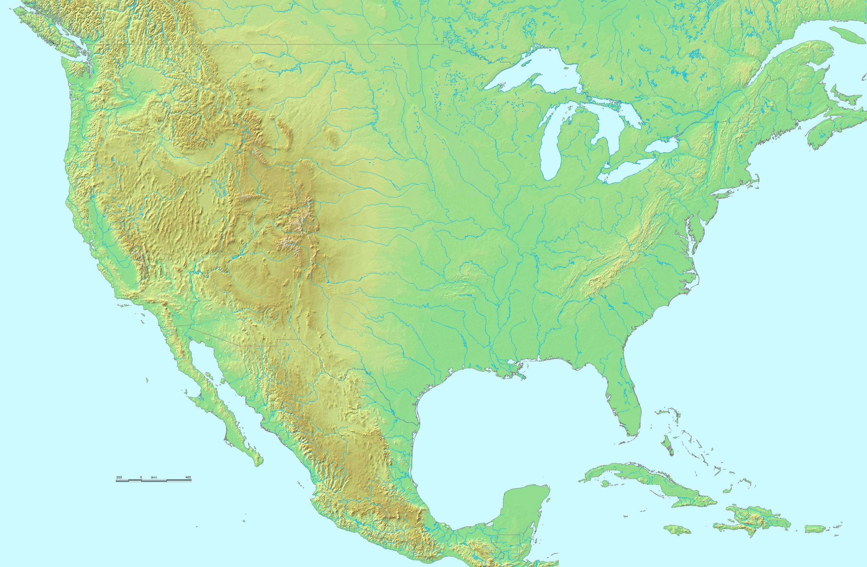
File:Topographic map of the USA.png
預覽大小:800 × 524 像素。 其他解析度:320 × 209 像素 | 640 × 419 像素 | 1,024 × 670 像素 | 1,280 × 838 像素 | 2,814 × 1,842 像素。
原始檔案 (2,814 × 1,842 像素,檔案大小:3.73 MB,MIME 類型:image/png)

摘要
| 描述 | Topographical map of the United States of America. |
| 來源 |
http://www.demis.nl/. They grant "permission to freely copy the PNG images returned by our server and use them for your own purposes, including web pages" on this page. Their maps are based on the following public domain databases:
|
| 作者 | DEMIS BV, and uploader. |
| 其他版本 | image:Map of USA with state names.svg |
授權條款
| 此作品已由其作者,demis.nl,釋出至公有領域。此授權條款在全世界均適用。 這可能在某些國家不合法,如果是的話: demis.nl授予任何人有權利使用此作品於任何用途,除受法律約束外,不受任何限制。
|
檔案歷史
點選日期/時間以檢視該時間的檔案版本。
| 日期/時間 | 縮圖 | 尺寸 | 使用者 | 備註 | |
|---|---|---|---|---|---|
| 目前 | 2022年11月17日 (四) 03:18 | | 2,814 × 1,842(3.73 MB) | Tube of Light | Removed hand icon off the California coast |
| 2010年11月9日 (二) 23:36 |  | 2,814 × 1,842(3.89 MB) | Avenue | Cloned away hand icons | |
| 2006年6月27日 (二) 18:26 |  | 2,814 × 1,842(3.93 MB) | Huebi~commonswiki | {{Information| |Description=Topological map of USA |other_versions=image:Map of USA with state names.svg }} Category:Maps of the United States {{PD}} |
檔案用途
沒有使用此檔案的頁面。
全域檔案使用狀況
以下其他 wiki 使用了這個檔案:
- de.wikipedia.org 的使用狀況
- fr.wikipedia.org 的使用狀況
- fr.wikiversity.org 的使用狀況
- ksh.wikipedia.org 的使用狀況
- mwl.wikipedia.org 的使用狀況
- uk.wikipedia.org 的使用狀況