贝尔尼瑟
外观
此條目需要擴充。 (2011年5月26日) |
| 贝尔尼瑟 Bernisse | |
|---|---|
| 旧市镇 | |
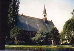
 位于奥登霍伦(Oudenhoorn)的教堂 | |
 贝尔尼瑟在南荷兰省的位置 | |
| 坐标:51°51′N 4°15′E / 51.850°N 4.250°E | |
| 国家 | |
| 省份 | 南荷兰省 |
| 市镇 | 尼瑟瓦尔德 |
| 面积[1] | |
| • 总计 | 68.46 平方公里(26.43 平方英里) |
| • 陸地 | 57.34 平方公里(22.14 平方英里) |
| • 水域 | 11.12 平方公里(4.29 平方英里) |
| 海拔[2] | 0 公尺(0 英尺) |
| 人口(2021年年)[3] | |
| • 總計 | data missing人 |
| 时区 | CET(UTC+1) |
| • 夏时制 | CEST(UTC+2) |
| 邮政编码 | 3211–3218, 3227 |
| 电话区号 | 0181 |
| 網站 | www |
贝尔尼瑟(荷蘭語:Bernisse,法语:[bɛrˈnɪsə] (ⓘ))是荷兰南荷兰省的一个旧市镇。2004年人口12,684。面积68.59 km²,其中11.25 km²为水域。2015年1月1日,贝尔尼瑟与市镇斯派克尼瑟合并为新市镇尼瑟瓦尔德(Nissewaard)。
参考资料
[编辑]- ^ Kerncijfers wijken en buurten [地区关键统计数字]. 荷蘭中央統計局统计数据. 荷蘭中央統計局. 2013-07-02 [2014-03-12] (荷兰语).
- ^ Postcodetool for 3216AG. Actueel Hoogtebestand Nederland. Het Waterschapshuis. [14 July 2013]. (原始内容存档于2013-09-21) (荷兰语).
- ^ Bevolkingsontwikkeling; regio per maand [Population growth; regions per month]. CBS Statline. CBS. 2022年1月1日 [2022年1月2日] (荷兰语).

