
File:Atlas Van der Hagen-KW1049B11 048-HIBERNIAE REGNUM tam in praecipuas ULTONIAE, CONNACIAE, LAGENIAE, et MOMONIAE, quam in minores earundem Provincias, et Ditiones subjacentes peraccuraté divisum.jpeg

本预览的尺寸:509 × 600像素。 其他分辨率:204 × 240像素 | 407 × 480像素 | 651 × 768像素 | 869 × 1,024像素 | 1,737 × 2,048像素 | 4,666 × 5,500像素。
原始文件 (4,666 × 5,500像素,文件大小:7.02 MB,MIME类型:image/jpeg)
摘要
| Dirk Jansz van Santen:Atlas van Dirk van der Hagen (volledig, collectie KB)
|
|||||||||||||||||||||||||||
|---|---|---|---|---|---|---|---|---|---|---|---|---|---|---|---|---|---|---|---|---|---|---|---|---|---|---|---|
| 艺术家 |
|
 | |||||||||||||||||||||||||
| 作者 |
Author and publisher: Nicolaes Visscher II |
||||||||||||||||||||||||||
| 标题 |
HIBERNIAE REGNUM tam in praecipuas ULTONIAE, CONNACIAE, LAGENIAE, et MOMONIAE, quam in minores earundem Provincias, et Ditiones subjacentes peraccuraté divisum |
||||||||||||||||||||||||||
| 物体类型 | 地圖 | ||||||||||||||||||||||||||
| 描述 |
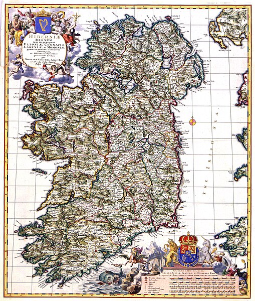
Nederlands: Deze kaart van Ierland werd omstreeks 1689 gepubliceerd door Nicolaes Visscher II (1649-1702). We kunnen dat afleiden uit het feit dat de kaart is opgedragen aan stadhouder Willem III en zijn vrouw Mary Stuart die in 1689 tot koning en koningin van Engeland, Schotland en Ierland waren gekroond.; Rechtsonder een opdracht van Nicolaes Visscher II aan Willem III en Mary Stuart.
English: This map of Ireland was published by Nicolaes Visscher II (1649-1702) about 1689. These facts are known because the map is dedicated to stadholder William III and his wife Mary Stuart who were crowned as king and queen of England, Scotland and Ireland in 1689. |
||||||||||||||||||||||||||
| 语言 |
荷蘭語 |
||||||||||||||||||||||||||
| 日期 | 约1689年 | ||||||||||||||||||||||||||
| 出版日期 |
约 |
||||||||||||||||||||||||||
| 表现形式 |
Nederlands: kopergravure
English: 铜雕刻 |
||||||||||||||||||||||||||
| 尺寸 | 56 x 47 cm | ||||||||||||||||||||||||||
| 館藏 | |||||||||||||||||||||||||||
| 登录号 |
Description of the Atlas Van der Hagen in the catalogue of the KB: http://opc4.kb.nl/DB=1/TTL=1/LNG=EN/PPN?PPN=353012750 |
||||||||||||||||||||||||||
| 创作地点 | Amsterdam | ||||||||||||||||||||||||||
| 备注 | KW1049B11_048 - Volume 1 | ||||||||||||||||||||||||||
| Related persons | Nicolaes Visscher II - Willem III - Stuart, Mary | ||||||||||||||||||||||||||
| Depicted locations | Ireland | ||||||||||||||||||||||||||
| 参考 | |||||||||||||||||||||||||||
| 来源/摄影师 |
Source page at the Geheugen van Nederland / Memory of the Netherlands website.
|
||||||||||||||||||||||||||
| 授权 (二次使用本文件) |
|
||||||||||||||||||||||||||
| 其他版本 |
 |
||||||||||||||||||||||||||

文件历史
点击某个日期/时间查看对应时刻的文件。
| 日期/时间 | 缩略图 | 大小 | 用户 | 备注 | |
|---|---|---|---|---|---|
| 当前 | 2018年2月8日 (四) 12:07 | | 4,666 × 5,500(7.02 MB) | Gryffindor | {{Information |Description= |Source={{own}} |Date= |Author= Gryffindor |Permission= |other_versions= }} |
| 2015年7月18日 (六) 15:32 |  | 4,666 × 5,500(4.95 MB) | OlafJanssen | GWToolset: Creating mediafile for OlafJanssen. |
文件用途
以下6个页面使用本文件:
全域文件用途
以下其他wiki使用此文件:
- ar.wikipedia.org上的用途
- arz.wikipedia.org上的用途
- bn.wikipedia.org上的用途
- ca.wikipedia.org上的用途
- el.wikipedia.org上的用途
- en.wikipedia.org上的用途
- United Kingdom of Great Britain and Ireland
- Irish Republic
- Kingdom of Ireland
- Lordship of Ireland
- History of Northern Ireland
- History of the Republic of Ireland
- History of Ireland (400–795)
- History of the Jews in Ireland
- History of Ireland (1801–1923)
- Template:History of Ireland sidebar
- Economic history of Ireland
- List of conflicts in Ireland
- History of Ireland (1169–1536)
- History of Ireland (795–1169)
- Irish independence
- History of Ireland (1536–1691)
- History of Ireland (1691–1800)
- Prehistoric Ireland
- User:Angusmclellan/Early Christian Ireland
- User talk:Dppowell/Archive1
- Gaelic Ireland
- User:Dppowell/Sandbox/Early Christian Ireland
- Military history of Ireland
- History of Ireland
- Protohistory of Ireland
- User:Finnrind/Historiography
- Hiberno-Roman relations
- Talk:History of Ireland/Archive 3
- User:༆/History of Europe templates
- User:Nashrobert18
- Timeline of Dublin
- Template:History of Ireland sidebar/testcases
- List of participants in the Nine Years' War (Ireland)
- Human rights in Ireland
- Timeline of Belfast history
- User:Mooze17/sandbox
- es.wikipedia.org上的用途
- eu.wikipedia.org上的用途
- ga.wikipedia.org上的用途
- gl.wikipedia.org上的用途
- hu.wikipedia.org上的用途
查看本文件的更多全域用途。