
File:Czech army Sgt. Van Kmecik and Croatian army Master Sgt. Bravko Horvat discuss patrol routes.jpg

原始文件 (5,616 × 3,744像素,文件大小:5.47 MB,MIME类型:image/jpeg)
摘要
| 描述 |
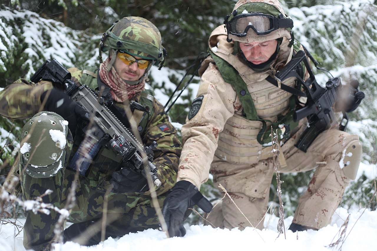
Czech army Sgt. Van Kmecik and Croatian army Master Sgt. Bravko Horvat discuss patrol routes while patrolling through the woods during a military advisory team training exercise at the Joint Multinational Readiness Center in Hohenfels, Germany, Dec. 10, 2012. MATs and police advisory team rotations are designed to replicate the Afghanistan operational environment while preparing teams for counterinsurgency and improvised explosive device operations with the ability to train, advise and enable the Afghanistan National Army and the Afghanistan National Police. (U.S. Army photo by Spc. Tristan Bolden/Released) VIPER COMBAT CAMERA USAREUR Photo by Spc. Tristan Bolden Date Taken:12.10.2012 Location:HOHENFELS, BW, DE Read more: www.dvidshub.net/image/800266/military-and-police-advisor... |
| 日期 | 摄于2012年12月10日, 14:58 |
| 来源 |
Military and Police Advisory Training II at the Joint Multinational Readiness Center [Image 1 of 7]
|
| 作者 | DVIDSHUB |
| 相机位置 | | 在以下服务上查看本图像和附近其他图像: OpenStreetMap |
|---|
许可协议
|
|
 |
| 此张图片原发布于Flickr,在2013年2月10日由管理员或审查员File Upload Bot (Magnus Manske)检查后,确认检查时图片在Flickr的版权声明与维基共享资源的版权使用方针相符。 |

|
本图像是美国陆军的军人或雇员在执行个人官方任务期间拍摄或制作的作品,编号为121210-A-PU716-007。
|
文件历史
点击某个日期/时间查看对应时刻的文件。
| 日期/时间 | 缩略图 | 大小 | 用户 | 备注 | |
|---|---|---|---|---|---|
| 当前 | 2013年2月10日 (日) 19:18 | | 5,616 × 3,744(5.47 MB) | File Upload Bot (Magnus Manske) | Transferred from Flickr by User:oaktree_b using flickr2commons |
文件用途
以下页面使用本文件:
全域文件用途
以下其他wiki使用此文件:
- en.wikipedia.org上的用途
- he.wikipedia.org上的用途
- it.wikipedia.org上的用途
- ko.wikipedia.org上的用途
- sh.wikipedia.org上的用途