
File:Czechoslovakia IV.png
本预览的尺寸:800 × 364像素。 其他分辨率:320 × 146像素 | 640 × 291像素 | 1,128 × 513像素。
原始文件 (1,128 × 513像素,文件大小:130 KB,MIME类型:image/png)
| 描述 |
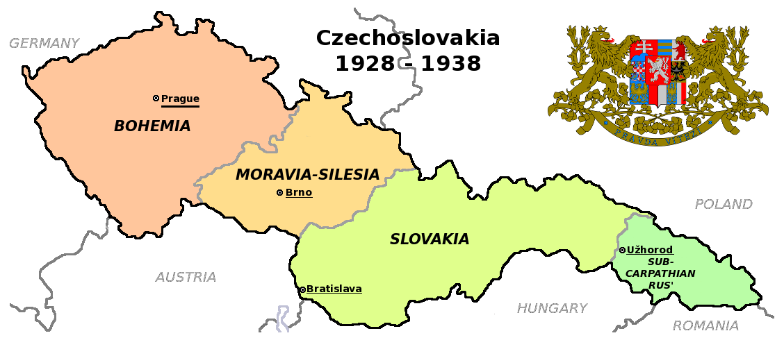
Čeština: Zemská mapa Československa v letech 1928 až 1938 s vyznačenými zemskými hlavními městy English: Maps of Czechoslovakia in 1928-1938 with marked borders of all four Czechoslovak lands and their regional capital cities |
| 日期 | (UTC) |
| 来源 | |
| 作者 |
|
| 其他版本 |
此文件衍生的作品: |
| 这是一张修改过的图片,这意味着它已在原版本的基础上通过软件进行了编辑,改动内容:Simplified map。其原始版本为:Czechoslovakia COA large.svg。修改者:Millenium187。
|
本文件采用知识共享署名-相同方式共享 3.0 未本地化版本许可协议授权。
- 您可以自由地:
- 共享 – 复制、发行并传播本作品
- 修改 – 改编作品
- 惟须遵守下列条件:
- 署名 – 您必须对作品进行署名,提供授权条款的链接,并说明是否对原始内容进行了更改。您可以用任何合理的方式来署名,但不得以任何方式表明许可人认可您或您的使用。
- 相同方式共享 – 如果您再混合、转换或者基于本作品进行创作,您必须以与原先许可协议相同或相兼容的许可协议分发您贡献的作品。
原始上传日志
This image is a derivative work of the following images:
- File:Czechoslovakia01.png licensed with PD-self
- 2011-05-19T10:54:48Z PANONIAN 1128x513 (64020 Bytes) minor change, marked provincial capitals
- 2011-05-17T09:53:27Z PANONIAN 1128x513 (63994 Bytes) Reverted to version as of 10:38, 24 April 2011 - because this is map of Czechoslovakia and it was capital of Czechoslovakia
- 2011-05-17T05:07:38Z Millenium187 1128x513 (56086 Bytes) Why was Prague underlined and Vienna, Brno, Bratislava and other capital cities were not? -- corrected
- 2011-04-24T10:38:30Z PANONIAN 1128x513 (63994 Bytes) few corrections
- 2011-04-23T11:31:49Z PANONIAN 1128x509 (62348 Bytes) improved version
- 2008-12-20T20:58:14Z Kirk 1100x497 (80038 Bytes) {{Information |Description= |Source= |Date= |Author= |Permission= |other_versions= }}
- 2006-12-28T16:11:35Z Electionworld 1100x497 (92110 Bytes) {{ew|en|PANONIAN}} Map of {{link|Czechoslovakia}} (self made) Note: The provinces shown on the map were introduced by Act No. 125/1927 Zb. and became effective in 1928. {{PD-self}} [[Category:Maps of Czechoslovakia]] [[Cat
- File:Czechoslovakia_COA_large.svg licensed with Cc-by-sa-3.0-migrated, GFDL
- 2010-09-06T23:55:59Z Fry1989 635x350 (1316079 Bytes) Reverted to version as of 23:52, 6 September 2010 this version will have to stay, message me with any corrections you want and I'll see what I can do
- 2010-09-06T23:53:49Z Kwasura 635x350 (1440388 Bytes) correction
- 2010-09-06T23:52:33Z Fry1989 635x350 (1316079 Bytes) lets see if it'll upload for me, checks out fine in inkscape
- 2010-09-06T23:50:19Z Kwasura 635x350 (1440373 Bytes) correction
- 2010-08-12T19:52:16Z Delta 51 635x350 (1440480 Bytes) Reverted to version as of 08:13, 5 November 2006 (the new versions don't work at all)
- 2010-08-09T20:16:25Z Kwasura 635x350 (1026422 Bytes) trying
- 2010-08-09T20:06:57Z Kwasura 635x350 (1976 Bytes) well, I just don't know how to do it...
- 2010-08-09T20:05:24Z Kwasura 635x350 (1976 Bytes) one more try
- 2010-08-09T20:02:09Z Kwasura 635x350 (1976 Bytes) correction 2nd try
- 2010-08-09T19:57:24Z Kwasura 635x350 (1976 Bytes) correction
- 2006-11-05T08:13:30Z Happenstance 635x350 (1440480 Bytes) crowns for the eagles
- 2006-06-17T05:00:05Z Happenstance 635x350 (1439900 Bytes) ==Author:== * commons: [[user:Shazz|Shazz]] * pl.wiki: [[w:pl:user:Shazz|Shazz]] ==Description== * '''cs:''' Znak Československa - velký * '''pl:''' Godło Czechosłowacji - duże * '''en:''' Coat of Arms of Czechoslovakia
Uploaded with derivativeFX
文件历史
点击某个日期/时间查看对应时刻的文件。
| 日期/时间 | 缩略图 | 大小 | 用户 | 备注 | |
|---|---|---|---|---|---|
| 当前 | 2011年8月12日 (五) 18:36 | | 1,128 × 513(130 KB) | Millenium187 | {{Information |Description={{cs|Zemská mapa Československa v letech 1928 až 1938}} {{en|Maps of Czechoslovakia in 1928-1938 with marked borders of all four Czechoslovak countries}} |Source=*File:Czechoslovakia01.png *[[:File:Czechoslovakia_COA_l |
文件用途
没有页面链接到本图像。
全域文件用途
以下其他wiki使用此文件:
- ca.wikipedia.org上的用途
- en.wikipedia.org上的用途
- fa.wikipedia.org上的用途
- fr.wikipedia.org上的用途
- ps.wikipedia.org上的用途