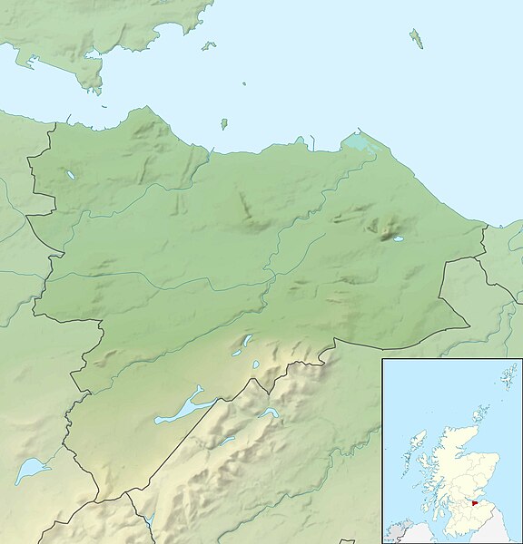
File:Edinburgh UK relief location map.jpg
外观

本预览的尺寸:576 × 600像素。 其他分辨率:230 × 240像素 | 461 × 480像素 | 737 × 768像素 | 983 × 1,024像素 | 2,005 × 2,088像素。
原始文件 (2,005 × 2,088像素,文件大小:285 KB,MIME类型:image/jpeg)
文件历史
点击某个日期/时间查看对应时刻的文件。
| 日期/时间 | 缩略图 | 大小 | 用户 | 备注 | |
|---|---|---|---|---|---|
| 当前 | 2011年11月30日 (三) 12:20 |  | 2,005 × 2,088(285 KB) | Nilfanion | {{Information |Description=Relief map of Edinburgh, UK. Equirectangular map projection on WGS 84 datum, with N/S stretched 175% Geographic limits: *West: 3.47W *East: 3.05W *North: 56.05N *South: 55.80N |Source=[[w:Ordnance Survey|Ordnan |
文件用途
以下2个页面使用本文件:
全域文件用途
以下其他wiki使用此文件:
- ar.wikipedia.org上的用途
- ba.wikipedia.org上的用途
- bg.wikipedia.org上的用途
- ceb.wikipedia.org上的用途
- de.wikipedia.org上的用途
- Duddingston Loch
- Dunsapie Loch
- Arthur’s Seat (Edinburgh)
- Merchiston Tower
- Threipmuir Reservoir
- Harlaw Reservoir
- Capelaw Hill
- Allermuir Hill
- Caerketton Hill
- Bonaly Reservoir
- Clubbiedean Reservoir
- Torduff Reservoir
- Vorlage:Positionskarte Schottland Edinburgh
- Lennox Tower
- Liberton Tower
- Castle Rock (Edinburgh)
- en.wikipedia.org上的用途
- Arthur's Seat
- Calton Hill
- Pentland Hills
- Cramond Island
- Corstorphine Hill
- Old Town, Edinburgh
- Module:Location map/data/United Kingdom Edinburgh/doc
- Braid Hills
- Castle Rock (Edinburgh)
- Blackford Hill
- Edinburgh Central Mosque
- Craiglockhart Hill
- Module:Location map/data/United Kingdom Edinburgh
- Module:Location map/data/Edinburgh
- User:Adrianmckie/sandbox
- Queensferry Lifeboat Station
- East Cairn Hill
- Caerketton Hill
- fr.wikipedia.org上的用途
- he.wikipedia.org上的用途
- hi.wikipedia.org上的用途
- id.wikipedia.org上的用途
- ja.wikipedia.org上的用途
查看此文件的更多全域用途。

