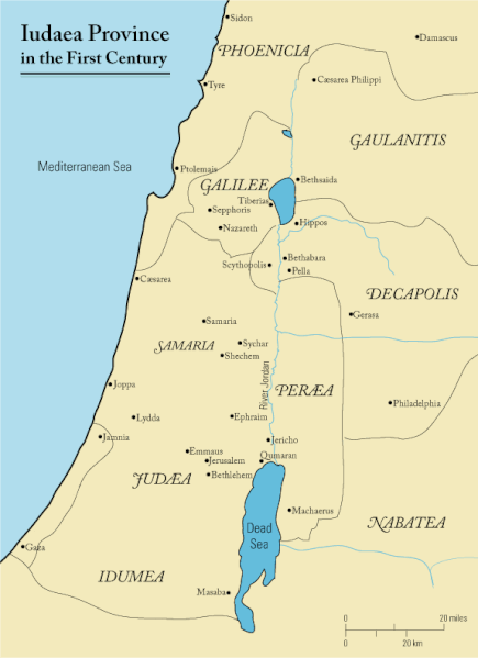
File:First century Iudaea province.gif

本预览的尺寸:435 × 599像素。 其他分辨率:174 × 240像素 | 575 × 792像素。
原始文件 (575 × 792像素,文件大小:31 KB,MIME类型:image/gif)
文件历史
点击某个日期/时间查看对应时刻的文件。
| 日期/时间 | 缩略图 | 大小 | 用户 | 备注 | |
|---|---|---|---|---|---|
| 当前 | 2011年9月18日 (日) 11:47 |  | 575 × 792(31 KB) | Onceinawhile | Removed region-name "Philistia", as incorrect |
| 2007年9月13日 (四) 14:05 |  | 575 × 792(32 KB) | Liftarn | {{SVG|map}} {{Information |Description=This is a map of first century en:Iudaea Province that I created using Illustrator CS2. I traced [http://commons.wikimedia.org/wiki/Image:Map_of_administrative_regions_in_Israel.png this] image for the general g | |
| 2006年4月30日 (日) 00:29 |  | 575 × 792(32 KB) | Duende~commonswiki | http://en.wikipedia.org/wiki/Image:First_century_palestine.gif |
文件用途
以下4个页面使用本文件:
全域文件用途
以下其他wiki使用此文件:
- af.wikipedia.org上的用途
- ar.wikipedia.org上的用途
- azb.wikipedia.org上的用途
- be-tarask.wikipedia.org上的用途
- be.wikipedia.org上的用途
- bg.wikipedia.org上的用途
- bn.wikipedia.org上的用途
- br.wikipedia.org上的用途
- ca.wikipedia.org上的用途
- co.wikipedia.org上的用途
- cs.wikipedia.org上的用途
- cy.wikipedia.org上的用途
- da.wikipedia.org上的用途
- de.wikipedia.org上的用途
- el.wikipedia.org上的用途
- en.wikipedia.org上的用途
- History of Jordan
- Titus
- Berenice (daughter of Herod Agrippa)
- Parable of the Good Samaritan
- Historicity of Jesus
- Historical Jesus
- Life of Jesus
- Judaea (Roman province)
- Matthew 4:25
- Perea
- New Testament places associated with Jesus
- User:Andrew c/Jesus
- Marcus Antonius Julianus
- List of revolutions and rebellions
- User:Pedia-I/ Jesus
- Ventidius Cumanus
- History of the Jews in Jordan
- Early Christianity
- Far, Far Away on Judea's Plains
- Kosher Jesus
查看本文件的更多全域用途。


