
File:Ghana Map.jpg

本预览的尺寸:489 × 599像素。 其他分辨率:196 × 240像素 | 392 × 480像素 | 627 × 768像素 | 1,060 × 1,298像素。
原始文件 (1,060 × 1,298像素,文件大小:309 KB,MIME类型:image/jpeg)
摘要
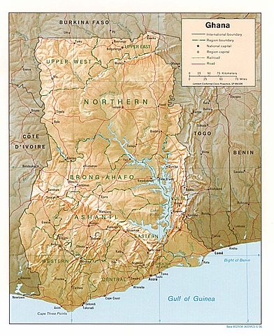
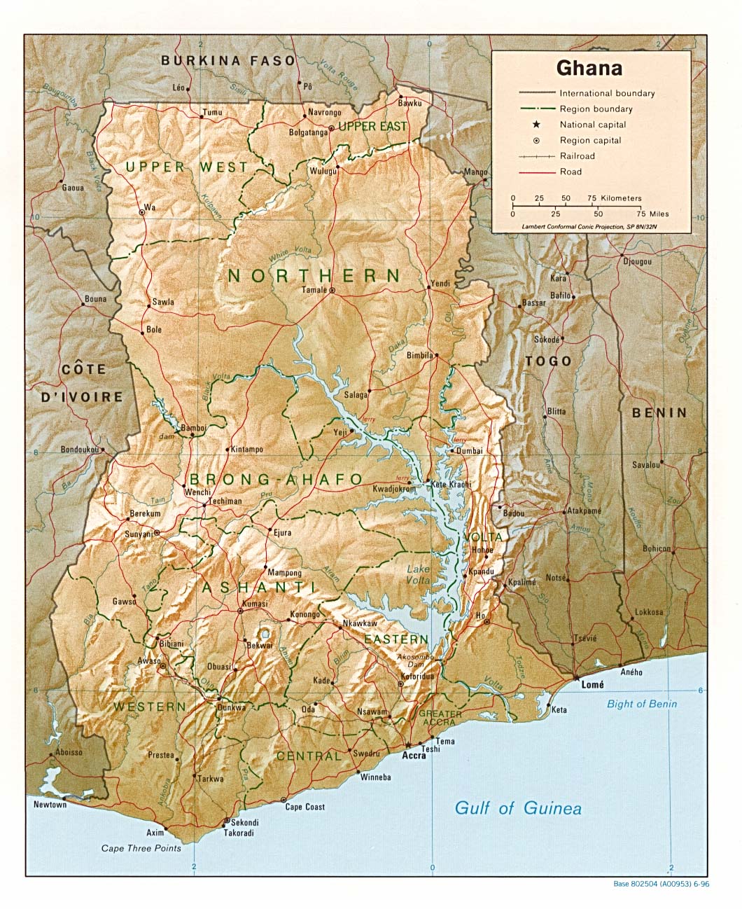
| 描述 | Shaded relief map of Ghana, 1996, produced by the U.S. Central Intelligence Agency. |
| 日期 | |
| 来源 | University of Texas Libraries, Perry-Castañeda Library Map Collection: Ghana maps |
| 作者 | CIA |
许可协议
| 本图像是中央情报局雇员的职务作品。作为美国联邦政府的作品,本图像或媒体属于公有领域。
|

|
文件历史
点击某个日期/时间查看对应时刻的文件。
| 日期/时间 | 缩略图 | 大小 | 用户 | 备注 | |
|---|---|---|---|---|---|
| 当前 | 2006年8月3日 (四) 18:46 | | 1,060 × 1,298(309 KB) | DO11.10 | Shaded relief map of Ghana. Image source: [http://www.lib.utexas.edu/maps/africa/ghana_rel95.jpg], from the [http://www.lib.utexas.edu/maps/ghana.html Perry-Castañeda Library Map Collection]. {{PD-USGov-CIA}} Category:Maps of Ghana |
| 2006年2月21日 (二) 10:50 |  | 1,341 × 1,653(570 KB) | Lupo | Shaded relief map of Ghana. Image source: [http://www.lib.utexas.edu/maps/africa/ghana_rel95.jpg], from the [http://www.lib.utexas.edu/maps/ghana.html Perry-Castañeda Library Map Collection]. {{PD-USGov-CIA}} Category:Maps of Ghana |
文件用途
以下页面使用本文件:
全域文件用途
以下其他wiki使用此文件:
- ast.wikipedia.org上的用途
- avk.wikipedia.org上的用途
- br.wikipedia.org上的用途
- de.wikipedia.org上的用途
- en.wikipedia.org上的用途
- es.wikipedia.org上的用途
- fa.wikipedia.org上的用途
- fr.wikipedia.org上的用途
- gag.wikipedia.org上的用途
- gd.wikipedia.org上的用途
- gl.wikipedia.org上的用途
- hr.wiktionary.org上的用途
- id.wikipedia.org上的用途
- it.wikipedia.org上的用途
- lfn.wikipedia.org上的用途
- lt.wikipedia.org上的用途
- ms.wikipedia.org上的用途
- pl.wikipedia.org上的用途
- simple.wikipedia.org上的用途
- sr.wikipedia.org上的用途
- tr.wikipedia.org上的用途
- uk.wikipedia.org上的用途
- vec.wikipedia.org上的用途
- wa.wikipedia.org上的用途
- yo.wikipedia.org上的用途